Although the pandemic wreaked havoc on supply chains and labor demands, the state’s massive improvement project along the Route 7 Corridor remains on track.
The $313.9 million project will improve seven miles of Route 7 between Reston Avenue and Jarrett Valley Drive is on schedule. Crews are working to widen the road from four to six lanes and add a shared-use path on both sides.
The project was not significantly impacted by staffing challenges and supply chain issues, a spokesperson for the Virginia Department of Transportation told Reston Now.
Kathleen Leonard, a spokesperson for VDOT, said that the design-to-build project team was able to take advantage of light traffic counts in 2012 to extend land closure hours and maintain progress throughout the pandemic.
But traffic patterns and a race-track environment are likely to remain for a little over two years.
Leonard says the project is 57 percent complete and on track for completion by July 31, 2024.
VDOT provided the following updates on the most recent work on the project:
Area 1: Reston Avenue to Colvin Forest Drive (Except Baron Cameron Avenue Intersection)
Area 1 West: Reston Avenue to Baron Cameron Avenue:
- Completed drilling for noise barrier foundations west of Reston Parkway along eastbound Route 7.
- Storm sewer installation west of Baron Cameron Avenue continued.
Area 1 East: Baron Cameron Avenue to Carpers Farm Way:
- Continued post installation for the noise barrier wall along westbound Route 7 between Colvin Run Road (east) and Colvin Run Road (west).
- Storm sewer installation between Baron Cameron Avenue and Colvin Forest Drive continued.
Area 2: Baron Cameron Intersection
- Continued earth-moving activities at the intersection of Route 7 and Baron Cameron Avenue.
Area 3: Difficult Run Area (Colvin Forest Drive to Faulkner Drive)
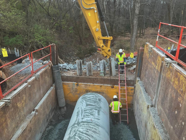
- Continued construction of the retaining wall between eastbound Route 7 and the Colvin Run stream channel.
- Construction of foundations for the piers and western abutment of the eastbound Route 7 bridge over Difficult Run continued.
- Completed storm sewer installation for Stage 2 between Difficult Run and Serenity Woods Lane.
- Completed storm sewer installation for Stage 3A between Serenity Woods Lane and Middleton Ridge Road.
- Installed underdrain, curb, and placed base and intermediate asphalt for Stage 2 between Towlston Road and Lewinsville Road.
- Placed base and intermediate asphalt between Lyons Street and Towlston Road.
- Completed the jack and bore storm sewer pipe crossing underneath Route 7 between Middleton Ridge Road and Newcombs Farm Road.
- Earth-moving activities for Stage 3B commenced between Lewinsville Road and Jarrett Valley Drive.
- Began installing storm sewer for the service road between McLean Bible Church and Laurel Hill Road.
Image via VDOT
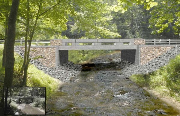
Construction on a $5.2 million bridge over Colvin Run is set to wrap up by the fall of next year.
The two-lane bridge on Hunter Mill Road over Colvin Run will replace a one-lane bridge that has been deemed structurally deficient by state and national standards.
The Virginia Department of Transportation began building in the bridge in August after launching a public engagement process in April 2018.
While VDOT is expected to fund most of the bridge through federal and state dollars, the department is asking the county to pitch in $408,000 to help construct a splitter island, median refuge, and rapid flashing beacons on bridge.
“The median refuge and RRFB will improve safety and accessibility of drivers, bicyclists, and pedestrians where Hunter Mill Road and the Colvin Run Stream Valley Trail intersect just south of the bridge. The bridge is also being designed to allow a future trail crossing of Colvin Run,” according to a memo prepared by county staff.
The Fairfax County Board of Supervisors will vote on an agreement to firm up the county’s contribution at a board meeting tomorrow.
The one-lane bridge had to be reinforced in an emergency move in February last year. The maximum load of the bridge was reduced to 10 tons and the lane width was reduced to 10 feet.
Construction was first expected to begin earlier this year but was later pushed to the summer.
The bridge was built in 1974 and averages roughly 8,500 vehicles per day, according to VDOT.
A construction contract was awarded to Clearwater Construction, Inc. in April.
The county board is expected to vote on a formal project administration agreement with VDOT so that the state can continue project work.
Photo via handout/VDOT
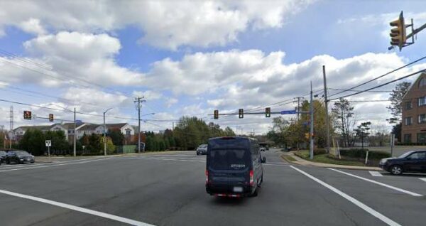
Traveling in Herndon north of the Dulles Toll Road, whether by car, bicycle, or as a pedestrian, could get easier after a $19 million project is completed in 2023.
The Virginia Department of Transportation is currently working on plans to widen Spring Street from four to six lanes between Herndon Parkway and Fairfax County Parkway (Route 286). The project will add more turn lanes on and around East Spring Street, create a cycle track on Herndon Parkway, and improve the area’s sidewalk infrastructure.
The changes seek to address traffic volume that’s projected to increase to an average of over 47,000 vehicles each day on East Spring Street in 2042, up from 38,000 vehicles on that stretch of road and 18,000 vehicles on Herndon Parkway today, according to VDOT’s project page.
Construction is slated to begin this winter with completion anticipated in fall 2023.
According to the Town of Herndon, the roadway widening involves:
- Expanding and reconstructing Spring Street from four to six lanes between Route 286 and Herndon Parkway
- Adding turn lanes on approaches to the Herndon Parkway and Spring Street intersection, including dedicated northbound right turn lanes on Herndon Parkway and a second left turn lane on southbound Herndon Parkway
- Adding a turn lane on the southbound Fairfax County Parkway off-ramp at Spring Street that’s solely for left turns
The cycle track will consist of an eight-foot-wide bicycle path separated from vehicular traffic as well as a six-foot-wide sidewalk that would replace the existing walkway on the east side of Herndon Parkway.
The two-way cycle track will run from the Washington & Old Dominion Trail, past the Spring Street intersection, and farther south to Hyatt House.
The dedicated bicycle path will support the Fairbrook Park redevelopment and other development projects expected to come with the eventual opening of the Herndon Metro station. It will ultimately extend to the Herndon Parkway and Van Buren Street intersection, where it will connect with a trail and bicycle lanes on Van Buren Street, according to the town.
The project will also introduce five-foot-wide, ADA-compliant sidewalks along Spring Street, according to a VDOT document.
While VDOT will be responsible for the project’s design and construction, maintenance of the completed bicycle path will be overseen by the Town of Herndon under a proposed license agreement with the state transportation department and the Northern Virginia Regional Park Authority (NOVA Parks), which owns the W&OD Trail.
If approved, the agreement would run through the end of 2060 but could be extended. VDOT would be required to give NOVA Parks $5,000 to cover potential expenses related to construction on the W&OD Trail, though the money will be returned within six months after the work is completed.
Once construction is finished, the licensing agreement would be transferred to the town.
The Herndon Town Council discussed the agreement during a work session yesterday (July 7) and is slated to address the item again at its next regular meeting on Tuesday (July 13).
Photo via Google Maps
Now, Reston residents can access detailed local transportation data with a click.
An interactive Reston Transportation Data Hub came online earlier this week, offering compiled data sets detailing how and when Restonians move about town.
The tool features vehicle, pedestrian, bicycle, and public transit data. Much of the data is from November 2019.
“This system provides a new way for residents to understand both the big picture and the details of our current and planned transportation system,” Walter Alcorn, Hunter Mill District Supervisor and Transportation Committee Chair, wrote in the press release. “Whether you drive, ride rail/buses, walk or bicycle, information on how the system fits together and coming improvements is critical. This data hub is an important step forward.”
Beyond that, the tool also maps upcoming transportation and infrastructure projects including timelines and costs. It also provides a comprehensive map of pedestrian and biking trails in Reston.
A high level analysis shows that traffic volume tends to be higher in Reston during the evening peak rush hour than the morning equivalent.
The report speculates that, along with commuting, this is due to the combination of errands and non-work trips that more often happen in the evening.
There are also other data hubs being planned, including ones showing zoning activity and parks that will show how land is being used in Reston.
Full press release below:
Reston residents, businesses and stakeholders can now access the latest information about transportation in the Reston area. The online, interactive Reston Transportation Data Hub features vehicle, pedestrian, bicycle, and public transit data, in addition to information about planned infrastructure improvements and transportation projects for Reston.
The Transportation Data Hub is one component of the Reston Data Visualization project. Led by the Fairfax County Department of Planning and Development Urban Center’s Section and GIS Department, the project focuses on data transparency associated with Reston development and infrastructure improvements, including information about mobility, parks, and zoning activity.
“This system provides a new way for residents to understand both the big picture and the details of our current and planned transportation system,” said Walter Alcorn, Hunter Mill District Supervisor and Transportation Committee Chair. “Whether you drive, ride rail/buses, walk or bicycle, information on how the system fits together and coming improvements is critical. This data hub is an important step forward.”
Additional Data Hubs are planned for the Reston Data Visualization project – including a Zoning Activity Data Hub and a Parks Hub – for sharing land use information with the Reston Community.
The main Reston Data Visualization page, which includes the Reston Transportation Data Hub, can be found at https://reston-data-visualization-fairfaxcountygis.hub.arcgis.com/. For questions about the new Transportation Data Hub or the Reston Data Visualization project, contact the Department of Planning and Development’s Urban Centers Section.
The Transportation Data Hub is a collaboration between Fairfax County’s Department of Planning and Development and Department of Transportation.
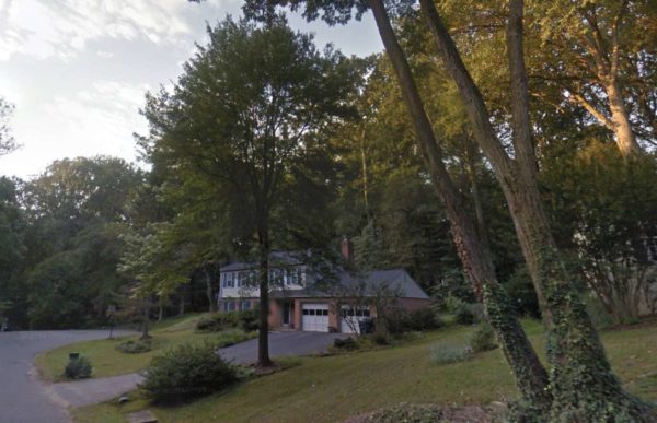
The installation of a “Watch for Children” sign is planned at Pinoak Lane in Reston in order to help calm residential traffic in the area.
The Fairfax County Board of Supervisors is expected to vote on the mitigation technique at a board meeting on Nov. 17, according to draft meeting materials.
The project is expected to cost $400 as is part of the county’s Residential Traffic Administration Program (RTAP). The program allows the county to install similar signs at the primary entrances of residential neighborhoods or in areas where there are areas where more children may congregate, including playgrounds, community centers, and daycares.
In a memo, county staff noted that the community wants the sign to be installed. Each request is reviewed by the Fairfax County Department of Transportation, which verifies that proposed signs will not conflict with any other traffic control devices.
Once the sign is approved by the board, installation is expected by the end of the year.
Image via Google Maps
Beginning July 28, lane shifts and traffic patterns will be changing between Utterback Store Road and Reston Avenue.
The Virginia Department of Transportation will be adding a third lane and shared-use paths in each direction, running about seven miles along Route 7.
The department is also adding a pedestrian underpass to access Colvin Run Mill Park, replacing and raising the bridge over Difficult Run and making more bicycle, pedestrian and intersection improvements, according to a statement from the department.
Work shifts will take place during daytime and overnight hours, according to the statement.
Starting on or around August 3, cleaning crews will begin work clearing during the daytime hours. All residences, businesses, and public facilities will still be accessible.
The speed limit on Route 7 will be reduced to 45 miles per hour in active work zones between Reston Avenue and Jarrett Valley Drive.
Photo via Virginia Department of Transportation

A local homeowners association has installed yard signs to encourage drivers to slow down following aSouth Lakes High School teenager was killed in a hit-and-run last year.
Marvin Daniel Cruz Serrano, 16, was struck by a vehicle while returning home from work at Reston’s Cafesano. Local police have not disclosed any leads on the case.
Serrano was crossing South Lakes Drive toward Castle Rock Square near the Bristol House Condos when he was hit by a car.
According to a report by NBC 4, which first reported the installation of the signs, the local homeowners association installed signs in late November to encourage residents to slow down.
Residents are also considering implementing a fine if two or more neighbors spot someone driving at a speed of more than 10 mph.
Photo via GoFundMe
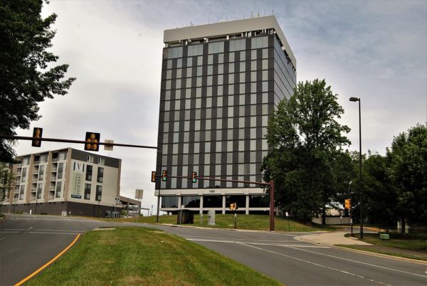
Traffic Changes on Dulles Toll Road and Sunset Hill Road This Week — Lane closures are scheduled beginning today (Monday) through Friday, Nov. 22, along the eastbound and northbound Dulles Toll Road and eastbound Sunset Hills Road near the future Reston Town Center Metro Station. [Dulles Corridor Metrorail Project]
Owner of Public Interest Registry to Sell Organization — The owner of Reston-based Public Internet Registry, which oversees customers in the .org domain, is set to sell the organization to a private equity company. [Washington Business Journal]
Free Locking Devices Available for Medications, Firearms — The county is offering free cable and trigger locks ad locking medication boxes. Individuals interested in the items can email [email protected] for more information. [Fairfax County Government]
Photo via vantagehill/Flickr
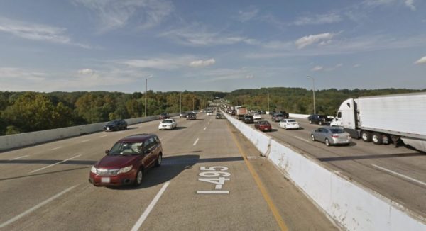
One of the region’s worst bottlenecks is expected to get some relief after state Gov. Ralph Northam announced a plan to expand the American Legion Bridge.
Virginia and Maryland, which will take the lead on the project, which Northam said was a “once-in-a-generation achievement for the capital region.” The interstate compact has been named the “Capital Beltway Accord”
Once completed, existing lanes in each direction across the Potomac River will be replaced and two new Express Lanes will be added in each direction for roughly three miles between George Washington Memorial Parkway in Virginia to River Road in Maryland. Trails on both sides of the Potomac River are planned to improve bicycle and pedestrian access.
Proud to stand with @GovLarryHogan to announce our new, historic Capital Beltway Accord. Finally, our two states have come together to rebuild the American Legion Bridge—a big win for Northern Virginia, the metro region, and our entire Commonwealth.https://t.co/lamx5p3zqr pic.twitter.com/av4wOhzYjI
— Ralph Northam (@GovernorVA) November 12, 2019
“This is once-in-a-generation project that will improve accessibility throughout the region,” said Virginia Secretary of Transportation Shannon Valentine. “This is a milestone in regional cooperation. We in Virginia look forward to working hand-in-hand with Maryland to deliver this transformative transportation solution.”
Officials expect the changes to reduce congestion in regular lanes by 25 percent, providing 40 percent more lane capacity over the old bridge.
While Maryland would rebuild the Legion Bridge, Virginia would pay nearly half of the cost.
No homes or businesses are expected to require relocation as a result of the project, according to a statement from the governor’s office.
Daily traffic on the American Legion Bridge has grown by 390 percent since the bridge opened in 1962.
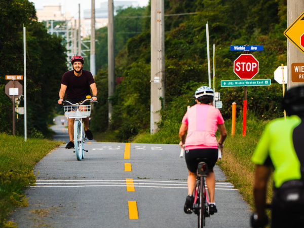
Annual Jigsaw Puzzle Sale Kicks Off Tomorrow — The Friends of Reston Regional Library will hold an annual jigsaw sale tomorrow from 10 a.m. to 7 p.m. [Reston Regional Library]
Delays on Leesburg Pike at Drainesville Road — Expect delays on Leesburg Pike at Drainesville Road this morning due to a crash. No left turns are allowed at the intersection and police encourage drivers to use caution. [Fairfax County Police Department]
Reston Association Website Back Online — The association’s website, which went down yesterday due to technical issues, is back online. The board is expected to meet tomorrow (Thursday) to discuss the budget and other issues. [Reston Association]
Photo via Flickr/Dario iparo
Update on Friday, July 26 at 8 a.m.: The road was reopened early Friday morning.
Commuters passing through Georgetown Pike at Seneca Road should plan to take a detour today (Thursday).
The Fairfax County Police Department indicated that the road is shutdown due to emergency repairs.
It is unclear how long the road will remain shutdown.
No other information was immediately available.
TRAFFIC ALERT: Georgetown Pk at Seneca Rd will be shutdown for emergency repairs. Please use an alternate route. #FCPD pic.twitter.com/bQzJU0e9Vw
— Fairfax County Police (@FairfaxCountyPD) July 25, 2019
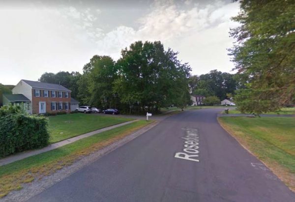
New speed humps are expected to be installed within the next several weeks along Rosedown Drive.
Four humps will be added to the road the request of the local homeowners association. The initiative is part of the county’s Residential Traffic Administration Program, which allows roads to be review for traffic calming procedures if requested by a board member.
Other speed humps could be added to Beverly Drive in Ashburn.
The total cost of both projects is $56,000. Funds are already appropriated in the county’s general fund.
The Fairfax County Board of Supervisors will vote on the projects at a meeting on Tuesday, July 16. If approved, construction would begin as soon as possible.
Map via Google Maps
Reston Community Center’s Board of Governors to Hold Annual Public Hearing Tonight — Attendees will learn more about RCC’s plans for the future, including a status report on the renovation of the Terry L. Smith Aquatics Center and the center’s annual report and strategic plan. The hearing is set for 6:30 p.m. at RCC Hunters Woods. [Reston Community Center]
Flash Flood Watch In Effect Today — A flash flood watch is in effect from 2 p.m. through this evening. Widespread thunderstorms and showers are expected. [National Weather Service]
Route 7 Widening Project to Provide Traffic Relief Soon — “The $313.9 million project is designed to ease congestion on a section of Route 7 that links northern and western Fairfax County and includes the busy Tysons area, which is undergoing a massive transformation of its own. The Northern Virginia Transportation Authority provided $10 million in funding. Other money for the project comes from Fairfax County and the state.” [The Washington Post]
Overnight Closures of Dulles Toll Road and Dulles Airport Access Road Ramps Planned This Week — “The ramps from the eastbound Dulles Toll Road and the eastbound Dulles Airport Access Road to the southbound I-495 (Capital Beltway) general purpose lanes will be closed nightly Monday night, June 17 through Friday night, June 21 for bridge work as part of the Jones Branch Connector project, ” [Virginia Department of Transportation]
Photo via vantagehill/Flickr
The Fairfax County’s Board of Supervisors greenlighted cut-through restrictions on Thomas Avenue today (June 4).
The restrictions would end Thomas Avenue serving as a conduit to get to Route 7 and the resulting traffic jams during rush hour along the narrow residential road.
Back in January, the Virginia Department of Transportation (VDOT) presented potential solutions and gathered feedback from locals concerning ways to limit cut-through traffic at the congested street that lies north of Herndon.
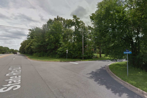
Now, VDOT can install a “No Right Turn” sign from southbound Algonkian Parkway onto westbound Thomas Avenue between 7-10 a.m.
This change has been in the works for almost three years, starting in 2016 with the county board endorsing a resolution to VDOT requesting that the avenue get considered for measures that reduce its volume of cut-through traffic.
Photo via Google Maps
State and local transportation officials have been working for more than a year on clearing the Soapstone Connector through the environmental approval phase — one of the latest hurdles for the roughly $170 million project.
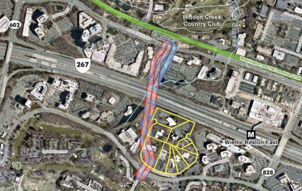
The connector — which extends Soapstone Drive from Sunrise Valley Drive over the Dulles Toll Road to Sunset Hills Road — provides a new north-south alternative to tackle increasing traffic congestion on Wiehle Avenue. By the time the project breaks ground, hundreds of additional residential units are expected to come on the market in Reston.
County transportation officials are working with the Virginia Department of Historic Resources to determine the next steps for the project after the state determined a group of buildings on Association Drive the project could cut through are considered historic. The Fairfax County Department of Transportation must conduct an alternatives analysis to find possible ways to reduce the impact on the buildings.
Discussions have been ongoing for more than year. The county’s Architectural Review Board first determined the collection of buildings could be historically significant in early 2018. Since then, county staff have been trying to chart the best path forward to minimize the impact on the buildings — which are considered historic as a collection, but not on an individual basis.
More hurdles are expected as the project goes through design and planning. Construction isn’t expected to begin until the mid to late 2020s.
“Anytime you’re building a new major project in a built environment, it’s more challenging than if we’re working out in a cornfield,” Tom Biesiadny, FCDOT’s director, told Reston Now. “None of them are insurmountable.”
Although funding for the project has not been secured yet, Biesiadny says the county has enough dollars to finish project design, which will move forward once the county receives necessary environmental approvals. The county plans to then tackle right-of-way and land acquisition between 2022 and 2024. Utility relocation is also complicated by the fact that area businesses rely on fiber optic cables along Sunrise Valley Drive and Sunset Hills Road.
“At the moment, money is not holding anything up,” Biesiadny said. “It’s several years out before we need the construction dollars.”
So far, the project has $24 million secured from federal, regional and local funds. A $45.4 million grand application for Smart Scale funding has been submitted. The county plans to continue to aggressively apply for grant funding.
The connector has been on the county’s planning books for years. A hybrid design for the project received county approval in 2014.
Map via Fairfax County Government


