
DMV2Go — The wireless office on wheels offers DMV services, including driver’s license and ID card applications and renewals, driving records, vehicle titles, license plates, decals and more. Locals can find it at the pavilion in Reston Town Center today from 9 a.m. to 4 p.m. [DMV Virginia]
New digs — Right Source Marketing recently moved to new offices in Reston. The digital and content marketing agency also acquired new space in Timonium, Md. [@CarissHampton on Twitter]
Gusty day ahead — The National Weather Service issued a Wind Advisory for today. [NWS]
")
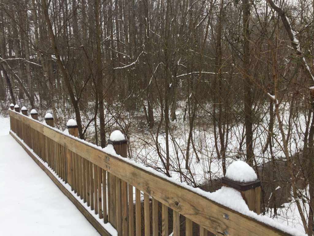
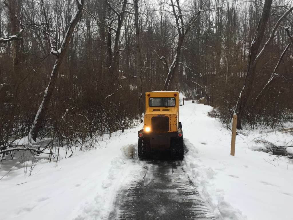
Locals can expect warmer temperatures later today, yet they should still be careful about ice and slick roads around Reston and Herndon today.
The D.C.-area could feel a high up to 52 degrees today, according to the National Weather Service. Yesterday’s rain and sleet after the snowstorm hit might create hazardous road conditions this morning.
The Virginia Department of Transportation is warning locals about icy spots and to be careful of any debris in the roadways. If you plan on walking outside, Fairfax County Fire and Rescue suggests a side-to-side “penguin” walk on any potentially icy ground.
Speaking of getting around, the Fairfax Connector is back to its regular service schedule today.
Melting, rain, melting, rain will be our pattern for the next few days.
💧 Icy spots this AM
💧 Headlights ON
💧 Watch for ponding & roadspray
💧 Watch for downed trees/debris
💧 Don’t go around road closed signs 🙄
💧 Report road hazards: https://t.co/12wxgee8pi or 800-FOR-ROAD pic.twitter.com/BWw3MxKgs6— VDOT Northern VA (@VaDOTNOVA) February 21, 2019
Be aware of icy spots out there this morning. Walk with caution and drive with care. Also clear snow and ice off the roof of your car! #FCFRD #FairfaxCounty pic.twitter.com/0saIHmfhrN
— Fairfax County Fire/Rescue (@ffxfirerescue) February 21, 2019
Photo via @greatfallsva/Instagram
People in Reston and Herndon have been capturing the progress of today’s snowstorm through pictures.
Locals put their photography skills to use for the snow-covered landscape, with some catching pets and cross-country skiing on camera.
Cool jacket! "Peony’s Snow Day In Reston" #snowday #chimein pic.twitter.com/vMeJHKbz2J
— Lindsey Mastis (@LindseyMastis) February 20, 2019
Many residents in Herndon and Reston brought rulers outside to help forecasters and fellow social media users follow along with the increasing snowfall. (Herndon saw around 4.5 inches of total snow accumulation, according to the National Weather Service.)
Right at 3” in Reston. Temp 31.2. @capitalweather @dougkammerer pic.twitter.com/ACZ1SvGnO3
— Bill Wheatley (@billwhe67) February 20, 2019
@capitalweather
About 2 1/2 so far in Reston. pic.twitter.com/7PqthF1LMf— wiredog (@KitCase3) February 20, 2019
Looks like we are at around 4” in Reston @capitalweather – mostly sleet coming down at this point. pic.twitter.com/DKiM3TlzwD
— C. G. Niederstrasser (@RocketScient1st) February 20, 2019
Photos via Marjorie Copson, Katie Butler, @simplylovinglife2019/Instagram, @cjhannas/Twitter and @greatfallsva/Instagram
Updated at 4:45 p.m. — Fairfax County Public Schools announced that schools will open two hours late tomorrow (Feb. 21). School offices and central offices will open on time.
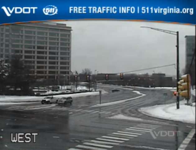
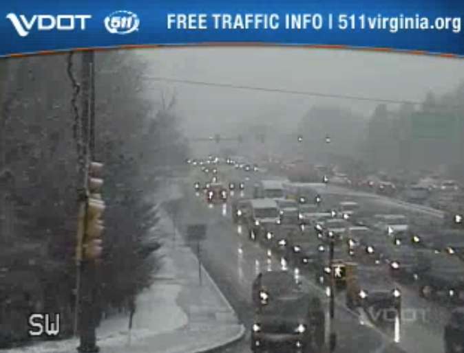
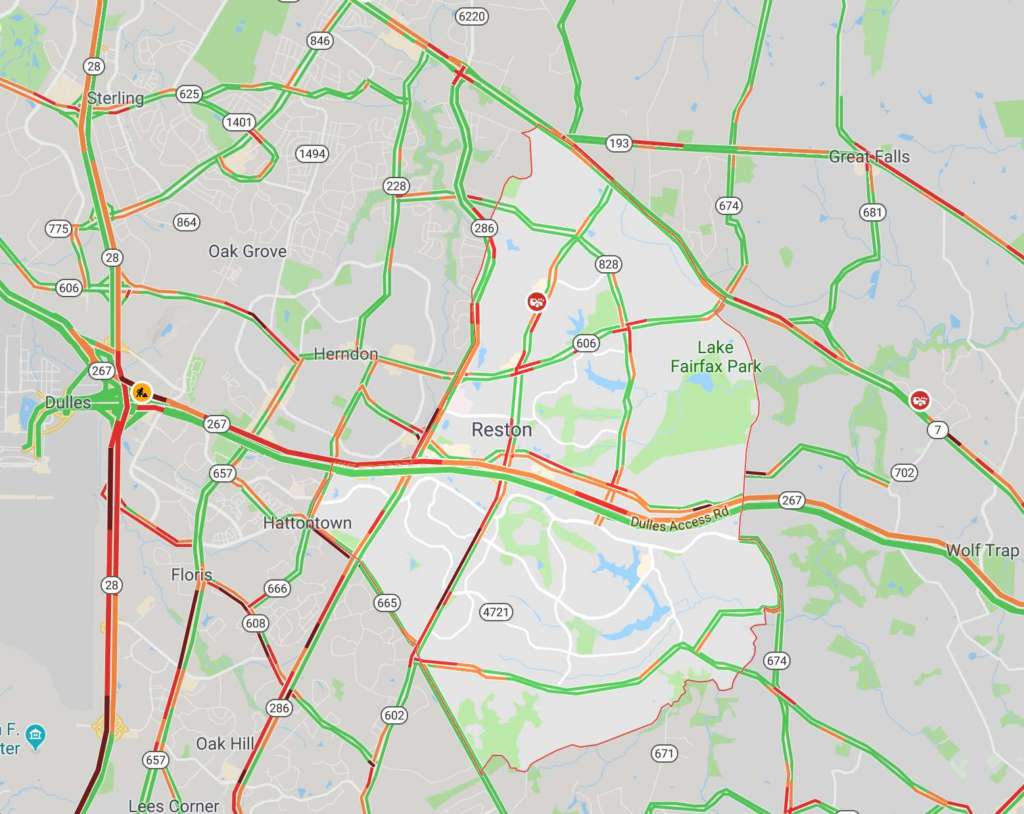
Earlier: Major roads appear clearer and mostly without traffic this afternoon, yet public safety officials keep asking locals to stay off of the roadways.
An emergency post from Fairfax County said that a number of traffic accidents took place today (Feb. 20) around the county. With sleet and rain recently replacing the snow, locals can expect slippery roads, the National Weather Service warns.
Herndon and Reston saw around 4.5 inches of total snow accumulation, according to NWS.
With the majority of the snow now changed over to sleet/ freezing rain, attention is turned to ice accumulations as temperatures only gradually warm above freezing. Advisories & Warnings continue through the evening, with the greatest ice accumulations north/west of I-95. pic.twitter.com/uNqXPPgPyB
— NWS Baltimore-Washington (@NWS_BaltWash) February 20, 2019
Several locals posted photos noting the change this afternoon from snow to a wintry mix of sleet and rain.
Sleet eroding snow in Reston @capitalweather pic.twitter.com/b7xIVFUUNr
— Bill Burton (@burtonwc) February 20, 2019
Looks like we are at around 4” in Reston @capitalweather – mostly sleet coming down at this point. pic.twitter.com/DKiM3TlzwD
— C. G. Niederstrasser (@RocketScient1st) February 20, 2019
https://twitter.com/hollyweatherwax/status/1098248450783760385
A Winter Weather Advisory is in effect for the county and surrounding area until 10 p.m. for snow, sleet and ice.
More from NWS:
WHAT…Mixed precipitation. Additional snow and sleet
accumulations of less than one inch through mid afternoon, then
ice accumulations of up to one tenth of an inch through 10 pm.
All freezing rain is expected to transition to rain by 10 pm.* WHERE…Portions of central and northern Virginia.
* WHEN…Until 10 PM EST this evening.
* ADDITIONAL DETAILS…Plan on slippery road conditions. The
hazardous conditions will impact the evening commute.PRECAUTIONARY/PREPAREDNESS ACTIONS…
A Winter Weather Advisory means that periods of snow, sleet or
freezing rain will cause travel difficulties. Expect slippery
roads and limited visibilities, and use caution while driving.When venturing outside, watch your first few steps taken on
steps, sidewalks, and driveways, which could be icy and slippery,
increasing your risk of a fall and injury.
The weather has prompted some event cancellations tonight in Reston and Herndon.
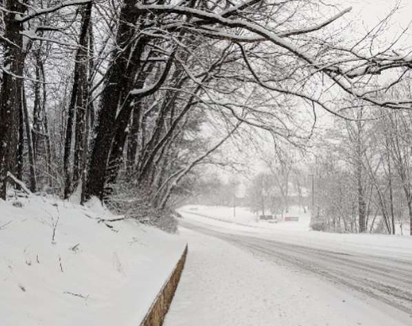
Images via Virginia 511, Google Maps and Marjorie Copson
")
Updated at 4:35 — FCPS tweeted that its schools will be closed tomorrow.
Earlier: This time tomorrow, locals in Reston and Herndon can expect snow, sleet and ice from a winter storm slated to hit late tonight.
Forecasts predict that snowfall will start between 3-5 a.m. on Wednesday (Feb. 20) before transitioning into freezing rain with sleet during the late afternoon. Snowfall is then expected to return before rain hits Wednesday night, according to Fairfax County Emergency Information.
The storm will likely leave between 4-6 inches of total snow accumulation and ice, posing risks for road safety.
The National Weather Service issued a Winter Storm Warning today ahead of the harsh, wintry weather.
More from the NWS:
WINTER STORM WARNING REMAINS IN EFFECT FROM 1 AM TO 7 PM EST WEDNESDAY…
* WHAT…Heavy mixed precipitation expected. Total snow accumulations of 3 to 6 inches and ice accumulations of up to one tenth of an inch expected.
* WHERE…The District of Columbia and portions of central Maryland and central and northern Virginia.
* WHEN…From 1 AM to 7 PM EST Wednesday. Snow will overspread the area early Wednesday morning and mix with and change to sleet and freezing rain during the late morning and early afternoon hours Wednesday. Precipitation will change to plain rain Wednesday evening. The heaviest snow is likely Wednesday morning.
* ADDITIONAL DETAILS…Travel could be very difficult. The hazardous conditions could impact the morning or evening commute.
PRECAUTIONARY/PREPAREDNESS ACTIONS…
A Winter Storm Warning means significant amounts of snow, sleet and ice will make travel very hazardous or impossible.
When venturing outside, watch your first few steps taken on steps, sidewalks, and driveways, which could be icy and slippery, increasing your risk of a fall and injury.
The Capital Weather Gang is uring workers to telecommute tomorrow morning. But if commuters do decide to hit the roads, they should “expect very difficult conditions,” the D.C.-area weather group tweeted.
The Virginia Department of Transportation said in a snow update this afternoon that crews have pretreated interstates and major routes throughout northern Virginia and that trucks get set up along roadways tonight so they will be ready to plow and treat roads tomorrow as needed.
Still, VDOT wants locals to “plan now to avoid driving through the day Wednesday and after the storm until conditions have improved.”
⚠️ Winter Storm Warning
⏰ Effective from 1 a.m – 7 p.m. Wednesday
❄️ 4-6 inches of snow and ice accumulations of up to one tenth of an inch
🚘 Hazardous travel conditions are expected
📲Stay informed: https://t.co/PAQyz4nJGn pic.twitter.com/AgVIpzppae— Ready Fairfax (@ReadyFairfax) February 19, 2019
Some places have already started announcing closures on Wednesday.
The Reston Animal Hospital and HealthWorks in Herndon will be closed, and the Greater Reston Chamber of Commerce canceled its events for tomorrow.
If you live in Herndon, don’t put out your recycling tonight. Mayor Lisa Markel posted on Facebook that recycling will be collected on Thursday instead.
Info from @TownOfHerndon: Prior to snow, please move cars off of roads so the snow plows can get through. Recyclables will NOT be picked up Wed, but picked up town-wide on Thu. Trash normally collected on Thurs will be collected on Fri. Updates here: https://t.co/azHcy0RddT pic.twitter.com/CzEGc0sZiy
— Herndon Police (@HerndonPolice) February 19, 2019
Whether you stay bundled inside or venture outdoors, stay safe and send Reston Now any pictures that you snap of the snow to [email protected] or tag us (@restonnow) on social media.
Photo by Marjorie Copson
")
Updated at 3:55 p.m. — NWS issued a Winter Weather Advisory for Fairfax, saying snow accumulation less than 1 inch is likely between 7 a.m. and noon on Friday. From 6 a.m. to 3 p.m. tomorrow, locals can expect surface temperatures “well below freezing.”
Earlier: The National Weather Service is warning drivers about possible icy roads Friday morning if snow hits Reston and surrounding areas.
NWS issued a Special Weather Statement Thursday afternoon to alert locals of possible snow tomorrow (Feb. 1).
More from the National Weather Service:
POTENTIAL WINTER COMMUTING HAZARD FOR THE BALTIMORE / WASHINGTON METRO AREAS FRIDAY MORNING…
There is a potential for hazardous commuting conditions for the Friday morning commute. A period of snow is POSSIBLE (a 30 percent chance south of Washington D.C. up to a 70 percent chance
in and north of Baltimore) Friday morning across the Baltimore / Washington metro areas. Snow may accumulate up to an inch for metro Washington D.C.. Snow may accumulate around an inch for
Baltimore with 1 to 2 inches possible north of Baltimore.If this threat does materialize during the Friday morning rush-hour, many untreated roads could quickly turn icy. This could lead to dangerous traveling conditions, multiple accidents, and extensive delays.
If commuting Friday morning, be aware of the POSSIBILITY of significant travel disruptions. Plan ahead by allowing for extra travel time, and consider using public transportation and telework options.
Snow tomorrow would be an early kick-off to the Capital Weather Gang’s predictions that February will have above average snowfall.
Drivers are encouraged to monitor forecasts and plan extra travel time during the morning rush hour.
The Virginia Department of Transportation tweeted that it is watching the weather as well.
Sooooorrrryyy… We hate to break it to Team Boring Moderate Weather, but on top of the frigid cold 🥶, looks like we may get some snow ❄️ tomorrow. Pls monitor the forecast. We will continue to do so, and will be ready to deploy. pic.twitter.com/k48aVsiEzw
— VDOT Northern VA (@VaDOTNOVA) January 31, 2019
Be alert for this potential weather Friday morning. https://t.co/NXpvPbMwIb
— Fairfax County Government 🇺🇸 (@fairfaxcounty) January 31, 2019
Photo by Marjorie Copson

Updated at 4:55 p.m. — NWS canceled the Wind Advisory that was set to last until 6 p.m.
Earlier: Locals should stay bundled up and cautious of icy roads as fast, freezing winds hit Reston and surrounding areas.
The National Weather Service issued a Special Weather Statement about a potential “flash freeze” and “intense snow” for this afternoon.
Untreated, wet roads and surfaces may become icy and create hazardous conditions for driving and walking.
More from the NWS:
FLASH FREEZE POTENTIAL THIS AFTERNOON FOR UNTREATED ROADS…
At 100 PM EST, an arctic front was crossing the region. The front will cross the Baltimore and Washington metro areas during the early and middle afternoon hours.
Temperatures behind the front will quickly drop about 10 degrees in less than 30 minutes and potentially cause a flash freeze of any untreated wet roads and surfaces such as roads, sidewalks, and
parking lots, causing treacherous travel or walking conditions.Along the front a quick burst of intense snow is also likely. A quick snow accumulation of less than one inch is possible, mainly on grassy surfaces as road temperatures ahead of the front are
above freezing. Winds will gust up to 50 mph.PRECAUTIONARY/PREPAREDNESS ACTIONS…
Sharply colder temperatures following the snow may cause any water or slush to freeze on untreated roads and sidewalks. Reduced speeds and distance between vehicles is advised.
Be prepared for areas of blowing snow. This could lead to temporary very low visibilities and the potential for dangerous driving conditions. If you are traveling and encounter adverse
winter driving conditions, reduce speed and make sure headlights are on. Also be alert for icy areas after the front passes and temperatures fall.
A Wind Advisory is also in effect until 6 p.m. tonight, along with a Wind Chill Advisory, which will last until 10 a.m. tomorrow (Jan. 31).
It’s important to stay warm as the temperature plummet.
Fairfax County Fire and Rescue has tips for how to dress for the cold, including how to layer clothing appropriately. “Not dressing appropriately and staying outside too long in cold temperatures could lead to serious cold-related illness and injury such as hypothermia or frostbite,” the post says.
Animals also need to stay warm. Fairfax County tweeted a reminder to pet owners to bring their furry friends inside and provide adequate shelter to keep them warm.
Artic Air Is Here! Stay Safe Inside And Outside! When inside your home, please make sure you warm up safely. When outside, please dress appropriately and avoid prolonged exposure to the cold. Several Cold weather tips here: https://t.co/djF6JH277M #fcfrd #polarvortex #frigid pic.twitter.com/uo8nfjcZfV
— Fairfax County Fire/Rescue (@ffxfirerescue) January 30, 2019
Special Weather Statement for potential flash freeze in Washington and Baltimore Metropolitan areas. See image or click https://t.co/Co0TQEOVgG for details. pic.twitter.com/HCbMXiRURl
— NWS Baltimore-Washington (@NWS_BaltWash) January 30, 2019
MT @fairfaxanimals: It's going to be EXTREMELY cold and we're urging everyone to remember comfort and well-being of pets! Bring pets indoors, and call @FairfaxCountyPD's Animal Protection at 703-691-2131 to report pets left outside in frigid temperatures! pic.twitter.com/txskrng9y8
— Fairfax County Government 🇺🇸 (@fairfaxcounty) January 30, 2019
File photo
This story has been updated
Updated at 4:55 p.m. — NWS canceled the Wind Advisory that was set to last until 6 p.m.
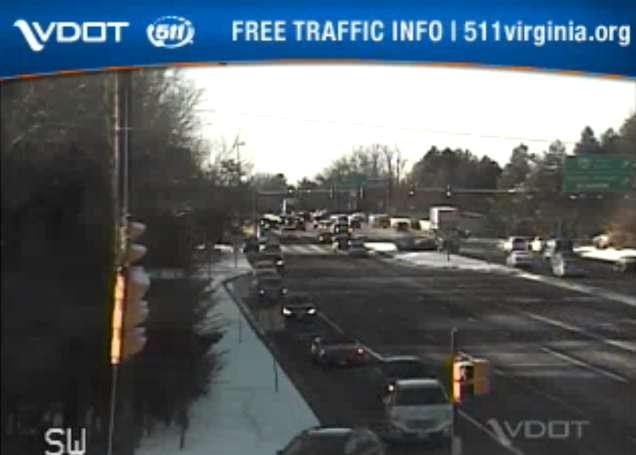
Earlier: After last night’s heavy congestion during rush hour, commuters are finding little to no traffic on major Reston roads this morning (Jan. 30).
Traffic on the Dulles Toll Road is flowing freely, according to Google Maps. However, drivers should still give themselves extra travel time for possibly icy local roads.
“Your commute will take longer today,” Fairfax County tweeted this morning, adding that crews worked overnight to treat roads and will continue treatment today if needed. Drivers are encouraged to reduce their speeds, use headlights and not brake quickly.
Be aware of black ice this morning! Please drive with caution. Your #FCFRD firefighters and paramedics don’t want to meet you by (preventable) “accident” today! 🚙🚗#snow #fairfaxcounty #traffic #vatraffic pic.twitter.com/t6g6nrA64K
— Fairfax County Fire/Rescue (@ffxfirerescue) January 30, 2019
Anybody stepping outside today should also bundle up. The National Weather Service issued a Wind Advisory until 6 p.m. tonight and a Wind Chill Advisory between 9 p.m. tonight and 10 a.m. tomorrow (Jan. 31).
More from the National Weather Service:
WIND CHILL ADVISORY REMAINS IN EFFECT FROM 9 PM THIS EVENING TO 10 AM EST THURSDAY…
* WHAT…Very cold wind chills of 5 to 10 degrees below zero.
* WHERE…Portions of central Maryland and northern Virginia including Washington DC and Baltimore MD.
* WHEN…From 9 PM this evening to 10 AM EST Thursday.
* ADDITIONAL DETAILS…The cold wind chills could result in hypothermia if precautions are not taken.
PRECAUTIONARY/PREPAREDNESS ACTIONS…
A Wind Chill Advisory means that cold air and the wind will combine to create low wind chills. Frostbite and hypothermia can occur if precautions are not taken. Dress in layers, and wear a hat and gloves.
Fairfax County Government offices are open today, however, employees have been granted unscheduled leave. Fairfax County public schools are closed today. Reston Association offices will open three hours late.
A meeting seeking public input on the Fairfax Connector has been canceled for tonight and will be rescheduled.
Locals have been busy snapping photos of the snow around Reston, including the following.
https://twitter.com/mellowdrifter/status/1090598252515393537
Images via Google Maps, Marjorie Copson and Virginia Department of Transportation
Update at 8:25 p.m. — Fairfax County Public Schools will be closed Wednesday.
Falling temperatures are expected to create hazardous travel conditions overnight and tomorrow, especially on secondary roads in various parts of the county. As a result, all Fairfax County public schools and offices will be closed Wednesday, Jan. 30, 2019 (Cond. 1).
— Fairfax Schools 🌟 (@fcpsnews) January 30, 2019
Snow accumulation is expected to lessen overnight and the temperature is going to drop. Ice will form on the roadways making driving conditions dangerous. Avoid driving if possible. If you do drive, reduce speeds and stay alert! Ice is difficult to spot. #FCPD pic.twitter.com/PZV6cOTkA8
— Fairfax County Police (@FairfaxCountyPD) January 30, 2019
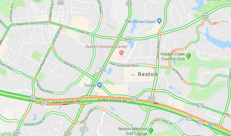
Earlier: Traffic is already starting to back up as commuters head home early to beat expected icy roads from today’s rain and snow.
Traffic is heavy heading westbound on the Dulles Toll Road, according to Google Maps, and drivers should also expect scattered heavy traffic on the Reston Parkway and other primary roads around the area.
A Winter Weather Advisory is currently in effect. Forecasters are warning commuters to be aware of potential travel disruptions and allow for extra time getting back in the evening. Additional problems on the roads are possible Wednesday morning.
From the National Weather Service:
WINTER WEATHER ADVISORY REMAINS IN EFFECT UNTIL MIDNIGHT EST TONIGHT…
* WHAT…Snow, mixed with rain before 5 PM, will turn to all snow by 5 PM this afternoon, and continue through the evening rush before ending between 7 and 9 PM this evening. Total snowfall accumulation around one inch is expected.
* WHERE…Arlington and Fairfax Counties in Virginia, the District of Columbia and its southern and eastern suburbs.
* WHEN…Winter Weather Advisory is in effect until midnight EST tonight.
* ADDITIONAL DETAILS…Plan on slippery road conditions. Temperatures will fall below freezing during the evening rush, causing the potential for wet or slushy surfaces to freeze.
Classes and activities at the Reston Community Center are canceled after 3 p.m. today, and RCC facilities are set to close by 5 p.m. The Reston Association offices also closed at 3 p.m.
Fairfax County public schools closed two hours early today.
Flakes started in the Reston area earlier this afternoon. As of 4 p.m., some local roads were becoming snow-covered.
Looking beautiful in Reston @fox5dc @fox5weather @Reston! ❄️❄️❄️ pic.twitter.com/ENzGSjangc
— Matt Bianco (@BiancoMSB) January 29, 2019
While drivers may not be enjoying the weather right now, at least one furry local is.
https://twitter.com/BranRob79/status/1090322798436847616
Images via Google Maps and Virginia Department of Transportation

Rain and snow are slated to hit Fairfax County tomorrow, possibly making roads slick from sudden weather changes.
The National Weather Service recently posted a Winter Weather Advisory at 2:58 p.m. today for Fairfax County and nearby areas beginning tomorrow.
NWS expects rain and snow late in the afternoon and early evening on Tuesday (Jan. 29). NWS anticipates about 1 to 3 inches of snow, with the abrupt transition from rain to snow creating poor driving conditions.
Commuters are encouraged to be aware of potential travel disruptions and allow for extra time getting back in the evening.
The advisory says the following:
WINTER WEATHER ADVISORY IN EFFECT FROM NOON TO 10 PM EST
TUESDAY…* WHAT…Any rain will change to snow during the afternoon hours.
Total snow accumulations of 1 to 3 inches expected.* WHERE…Portions of central and northern Maryland and northern
Virginia.* WHEN…From noon to 10 PM EST Tuesday.
* ADDITIONAL DETAILS…Plan on slippery road conditions. The
hazardous conditions will impact the evening commute.
Temperatures will fall well below freezing during the evening,
causing any moisture or slush to freeze on untreated surfaces.PRECAUTIONARY/PREPAREDNESS ACTIONS…
A Winter Weather Advisory for snow means periods of snow will
cause primarily travel difficulties. Expect snow covered roads
and limited visibilities, and use caution while driving.The latest road conditions for the state you are calling from can
be obtained by calling 5 1 1
From @NWS_BaltWash: If you plan on commuting Tuesday evening, be aware of the potential for travel disruptions. Plan ahead by allowing for extra travel time, and consider using public transportation and telework options. More details: https://t.co/zZL89SPjAy pic.twitter.com/3EfguqmsRi
— Fairfax County Government 🇺🇸 (@fairfaxcounty) January 28, 2019
Be prepared for an impacted Tues PM commute. Snow is forecast to hit around that time. Be aware that temps will drop (freezing) and the winds will pick up. Pls plan to leave work or be home a little early. Clear the roads so we can clear the roads. #teamwork pic.twitter.com/TuDjXbw29S
— VDOT Northern VA (@VaDOTNOVA) January 28, 2019
File photo
")
Sahaja Yoga Meditation — Head to the Herndon Fortnightly Library tonight from 7-8 p.m. for beginner’s yoga meditation. [Fairfax County]
Virginia’s public schools earn high marks — Two recent national studies rank Virginia’s public schools as among the highest performing in the nation. [Virginia Department of Education]
Flood Watch PSA — Fairfax County Fire and Rescue shared some National Weather Service safety tips as the Flood Watch continues until 3 p.m. today. [Fairfax County Fire and Rescue]
Reston’s MLK Day — Whether you attended the events over the weekend or want to know what you missed, this recap takes readers through the three-day celebration. [Connection Newspapers]
Photo via Marjorie Copson
 The National Weather Service (NWS) issued a Flood Watch today (Jan. 23) for late tonight through Thursday afternoon for Fairfax and much of the D.C. region.
NWS anticipates the heaviest rain to fall overnight and Thursday morning.
NWS expects around 1 inch of rain, with 1.5 to 2 inches possible.
NWS encourages locals to monitor later forecasts and to stay alert for possible Flood Warnings. Residents should prepare to take action if they live in areas prone to flooding.
More from the National Weather Service:
FLOOD WATCH REMAINS IN EFFECT FROM LATE TONIGHT THROUGH
THURSDAY AFTERNOON…The Flood Watch continues for
* Portions of Maryland, The District of Columbia, and Virginia,
including the following areas, in Maryland, Anne Arundel,
Carroll, Central and Southeast Howard, Central and Southeast
Montgomery, Charles, Frederick MD, Northern Baltimore,
Northwest Harford, Northwest Howard, Northwest Montgomery,
Prince Georges, Southeast Harford, and Southern Baltimore. The
District of Columbia. In Virginia, Arlington/Falls
Church/Alexandria, Eastern Loudoun, Fairfax, Northern
Fauquier, Prince William/Manassas/Manassas Park, Southern
Fauquier, Spotsylvania, Stafford, and Western Loudoun.* From late tonight through Thursday afternoon
* Rain will overspread the area this evening and overnight. The
heaviest rain is expected overnight and Thursday morning. Total
rainfall amounts around 1 inch are expected, with isolated
higher amounts of 1.5 to 2 inches possible.* Excess runoff from a nearly frozen ground and saturated soils
will cause the potential for streams and creeks to rise out of
their banks as well as potential flooding in low lying urban
areas.PRECAUTIONARY/PREPAREDNESS ACTIONS…
A Flood Watch means there is a potential for flooding based on
current forecasts.You should monitor later forecasts and be alert for possible
Flood Warnings. Those living in areas prone to flooding should be
prepared to take action should flooding develop.
The @NWS has issued a Flood Watch for @fairfaxcounty from this evening through Thursday afternoon. Heaviest rain expected overnight into early Thursday, with 1-1.5" possible. Be aware and be prepared! Info: https://t.co/6E2sMi5MHv #VAwx #Weather #FCFRD !� pic.twitter.com/eKjYR0a3Pq
— Fairfax County Fire/Rescue (@ffxfirerescue) January 23, 2019
Photo via Bahmad Farzad/Flickr
")
RA urges members to attend PRC meeting — In the latest Reston Today video, Reston Association’s Board President Andy Sigle urges RA members who are concerned about population density to attend a Jan. 23 meeting related to the county’s proposed amendment to the Planned Residential Community zoning ordinance. [YouTube]
Dense fog alert — This morning the National Weather Service issued a dense fog advisory until noon today for portions of the region, including Fairfax County. Drivers are encouraged to slow down, use their headlights and leave plenty of distance ahead of you. [National Weather Service]
“Superior Donuts” opens tonight — Reston Community Players’ production opens tonight at RCC Hunters Woods at 8 p.m. Tickets are $28. [Reston Community Center]
Ed-tech merger — Herndon-based Real Time Cases merged with Delray Beach, Fla.-based Elearis. The Herndon startup’s ideo-based business case studies paired up with the technology platform from Elearis for a new Herndon-based firm. [Washington Business Journal]
Photo via Marjorie Copson
")
Get ready for more snow.
The National Weather Service recently posted a winter weather advisory for the D.C.-area, including Fairfax County, from 6 p.m. tonight (Jan. 17) to 4 a.m. on Friday.
NWS expects around 1 inch of snow accumulation.
The advisory says the following:
Plan on slippery road conditions and
sidewalks. The hazardous conditions could impact the evening
commute after sunset as temperatures fall below freezing.PRECAUTIONARY/PREPAREDNESS ACTIONS…
A Winter Weather Advisory for snow means periods of snow will
cause primarily travel difficulties. Expect snow covered roads
and limited visibilities, and use caution while driving.The latest road conditions for the state you are calling from can
be obtained by calling 5 1 1.
The Virginia Department of Transportation is asking drivers to closely monitor forecasts for potential snow and ice impacting rush hours tonight and tomorrow, according to a “snow update” email this morning.
VDOT wrote that crews are staging along roads throughout the day to be ready for rush hour and have touched up pretreatment on areas prone to freezing, such as bridges, ramps and overpasses. They will also continue to work overnight to treat for icy conditions.
RT @NWS_BaltWash: Accumulating snow is expected late today and overnight. Winter Weather Advisories have been expanded over the DC and Baltimore metro areas. Be prepared for hazardous driving conditions. pic.twitter.com/U64T7TE46f
— Fairfax County Government 🇺🇸 (@fairfaxcounty) January 17, 2019
MT @VaDOTNOVA: Crews will be staged ahead of rush hour for snow during today’s PM commute. Pls leave work early (yay!) if you can. Storms during rush hour have a huge impact on the roads. Also watch for overnight freeze for tomorrow’s AM rush. 🥶❄️ pic.twitter.com/h9QIHoXLXb
— Fairfax County Government 🇺🇸 (@fairfaxcounty) January 17, 2019
Photo via Robbie Nolan/Twitter
")
Updated at 4:45 p.m. — Includes information from Fairfax County Public Schools.
Fairfax County is reminding locals of winter safety tips as the first snowfall of the year is anticipated to appear this weekend.
The National Weather Service forecast expects 3 to 4 inches, with snow moving into the area most likely after 1 p.m. on Saturday (Jan. 12) afternoon. By nightfall, about half of an inch will probably be on the ground, a Fairfax County Emergency Information post says.
Locals can expect temperatures tomorrow in the low to mid-30s with calm winds. Overnight, a steadier snowfall is expected to bring another 2 to 4 inches with temperatures in the upper 20s with a light wind of 5 miles per hour.
On Sunday (Jan. 13), snow should continue and then taper off by around 1 p.m. with temperatures in the low to mid-30s again. Winds may reach 5 to 8 mph. Additional snow showers on Sunday evening may occur, but aren’t expected to add to the accumulation.
In a video posted today (Jan. 11), Courtney Arroyo from the county’s Emergency Management Office urges residents to prepare by imagining the worst case scenario.
Her advice includes:
- making a communications plan including out of town contacts
- having alternative plans for work, daycare and elder care
- stocking up on items to survive at home for up to 72 hours, including nonperishable food, water, medications and any supplies for pets and children
- staying off of the roads
“Don’t get blindsided,” she says.
Meanwhile, Fairfax County Public Schools tweeted that all activities scheduled in Fairfax County public schools and school grounds are canceled beginning at 5 p.m. on Saturday and all day Sunday.
Happy Friday! With snow predicted for our region in the coming days, here are a few winter weather reminders as we head into the weekend: https://t.co/SmzA17v5Go @ReadyFairfax @fairfaxcounty @ffxconnector @VaDOTNOVA pic.twitter.com/stuHNqPukB
— Sharon Bulova (@SharonBulova) January 11, 2019
NEW: Winter weather advisory issued for immediate DC area for the weekend snow. Winter storm warning south of Fairfax County. Update: https://t.co/Ezc0aOOFDQ pic.twitter.com/XSCnhW2XDj
— Capital Weather Gang (@capitalweather) January 11, 2019
Photo via Charlotte Geary
This story has been updated