
Winter Weather Advisory In Effect — A Winter Weather Advisory is in effect for the area until noon today. Light, mixed precipitation is possible and snow accumulations of up to one inch are expected. [National Weather Service]
Reston Men Charged in Vehicle Pursuit — “An officer attempted to stop a 2007 Ford Focus for a traffic violation. The driver initially pulled over but then drove away, resulting in a pursuit. The driver, Chris Kpadeh, 20, of Reston, stopped down the road and was taken into custody. He was charged with reckless driving, speed to elude, and driving on a suspended license. A passenger, Mohamed Abdalla, 21, of Reston, was charged with two counts of possession of a concealed weapon and possessing a magazine for a firearm with the capacity of 20+ rounds.“ [Fairfax County Police Department]
No Snow Day Today — All county schools will take part in virtual learning today. Students will follow their regular Monday schedule for virtual instruction. [Fairfax County Public Schools]
Deadline for Reston Association Assessments Approaches — Members have until March 1 to pay their 2021 assessment. Installment plans are also available. [RA]
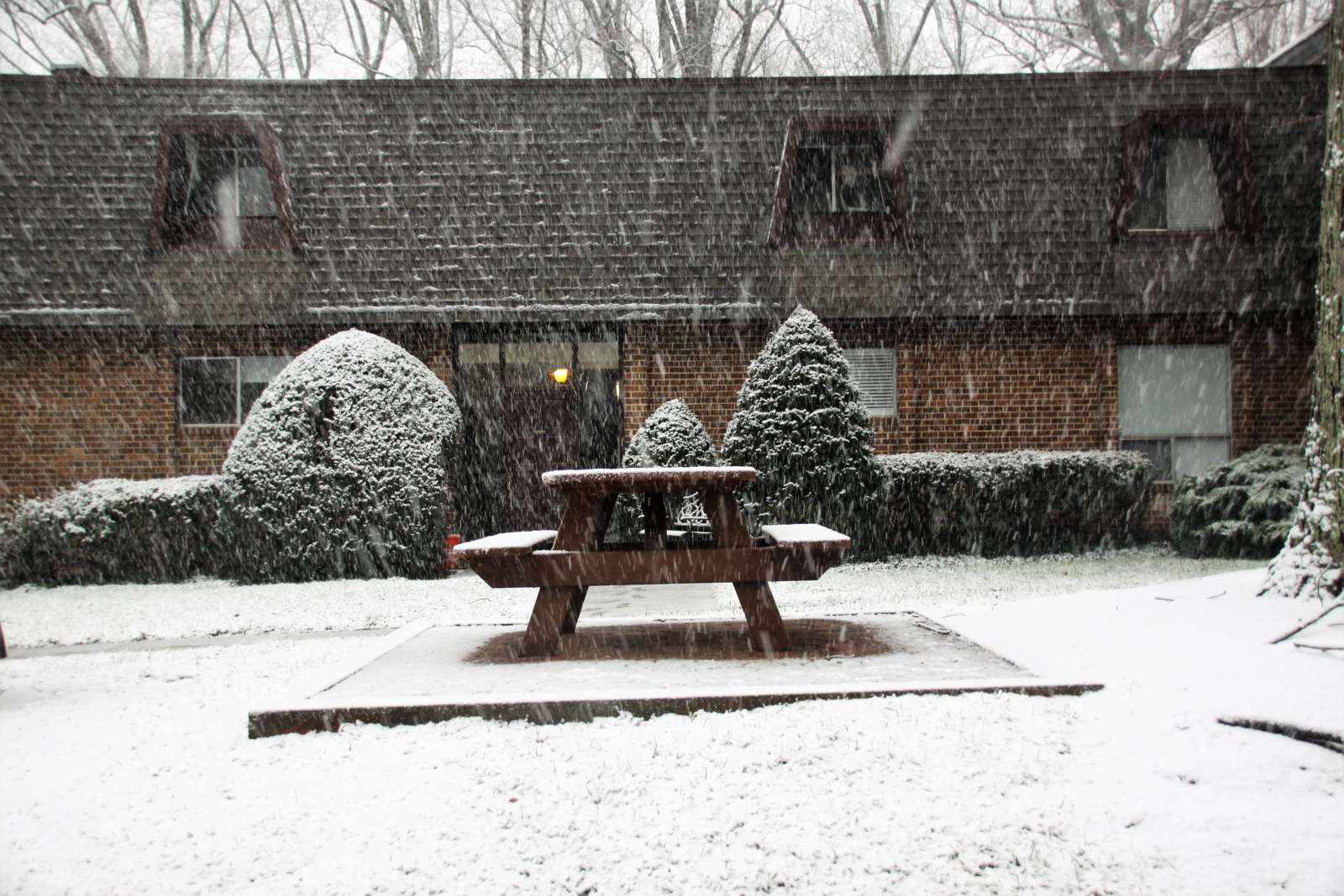
Photo via vantagehill/Flickr

Fairfax County and much of the region could see up to nine inches through tomorrow.
The National Weather Service issued a winter storm warning for the region last night. Snow accumulations between four and nine inches are expected.
The Virginia Department of Transportation is urging residents to avoid unnecessary travel during today’s storm.
So far, crews are treating roads and will begin to plow snow once it accumulates throughout the day.
“With more than 3,000 pieces of equipment, crews will work around the clock on state-maintained roads, focusing on clearing roads that carry the most traffic first. These include interstates, primary roads, and routes connecting public safety and emergency services. Crews can then focus on neighborhoods and lower-volume roads,’ VDOT wrote in a statement earlier this morning.”
Here’s more from NWS:
…WINTER STORM WARNING REMAINS IN EFFECT FROM 1 AM SUNDAY TO MIDNIGHT EST SUNDAY NIGHT…
* WHAT…HEAVY SNOW EXPECTED. SNOW ACCUMULATIONS THROUGH SUNDAY NIGHT AROUND 3 TO 6 INCHES WITH ICE ACCUMULATIONS AROUND ONE TENTH OF AN INCH.
* WHERE…THE WASHINGTON METROPOLITAN AREA.
* WHEN…FROM 1 AM SUNDAY TO MIDNIGHT EST SUNDAY NIGHT. SNOW WILL OVERSPREAD THE AREA BETWEEN 3 AND 5 AM EARLY SUNDAY MORNING. THE STEADIEST SNOW WILL FALL THROUGH SUNDAY AFTERNOON BEFORE TAPERING OFF TO AN INTERMITTENT MIX OF LIGHT SNOW, SLEET, AND FREEZING RAIN. ADDITIONAL SNOW IS EXPECTED MONDAY THROUGH MONDAY NIGHT WITH ADDITIONAL ACCUMULATIONS MOST LIKELY AROUND 1 TO 3 INCHES, BRINGING THE STORM TOTAL ACCUMULATIONS AROUND 4 TO 8 INCHES.
* IMPACTS…TRAVEL WILL BE VERY DIFFICULT SUNDAY THROUGH TUESDAY MORNING DUE TO A PROLONGED PERIOD OF SNOW AND WINTRY PRECIPITATION WITH TEMPERATURES NEAR OR BELOW FREEZING.
PRECAUTIONARY/PREPAREDNESS ACTIONS…
IF YOU MUST TRAVEL, KEEP AN EXTRA FLASHLIGHT, FOOD, AND WATER IN YOUR VEHICLE IN CASE OF AN EMERGENCY.
WHEN VENTURING OUTSIDE, WATCH YOUR FIRST FEW STEPS TAKEN ON STEPS, SIDEWALKS, AND DRIVEWAYS, WHICH COULD BE ICY AND SLIPPERY, INCREASING YOUR RISK OF A FALL AND INJURY.
VDOT also issued the following tips for residents
Stay home and avoid driving throughout the storm. Heavy snow bands will mean reduced visibility and potential for conditions to deteriorate quickly. Should the higher end of forecasts materialize, it will take some time to make a passable lane on all roads.
Park in driveways or a single side of the street to allow a wider path for plows.
View tips on shoveling driveways, as the plows will push some snow back. Take frequent breaks, especially when shoveling heavy, wet snow.
If you absolutely must travel, completely clear your car, reduce speeds significantly and use these winter driving tips. Use extreme caution on areas prone to freezing such as bridges, ramps and overpasses. Be prepared with gas and wiper fluid tanks and an emergency kit.
Monitor road conditions and traffic cameras from home on www.511virginia.org, on the free mobile app, or call 511 in Virginia.
Follow @vadotnova and @NWS_BaltWash for real-time updates. Learn more about snow removal at virginiadot.org/snow and stats for Northern Virginia.
Roads are slick as snow continues to fall. Please use caution and if possible, stay home! #FCPD pic.twitter.com/ppRbDMinUz
— Fairfax County Police (@FairfaxCountyPD) January 31, 2021
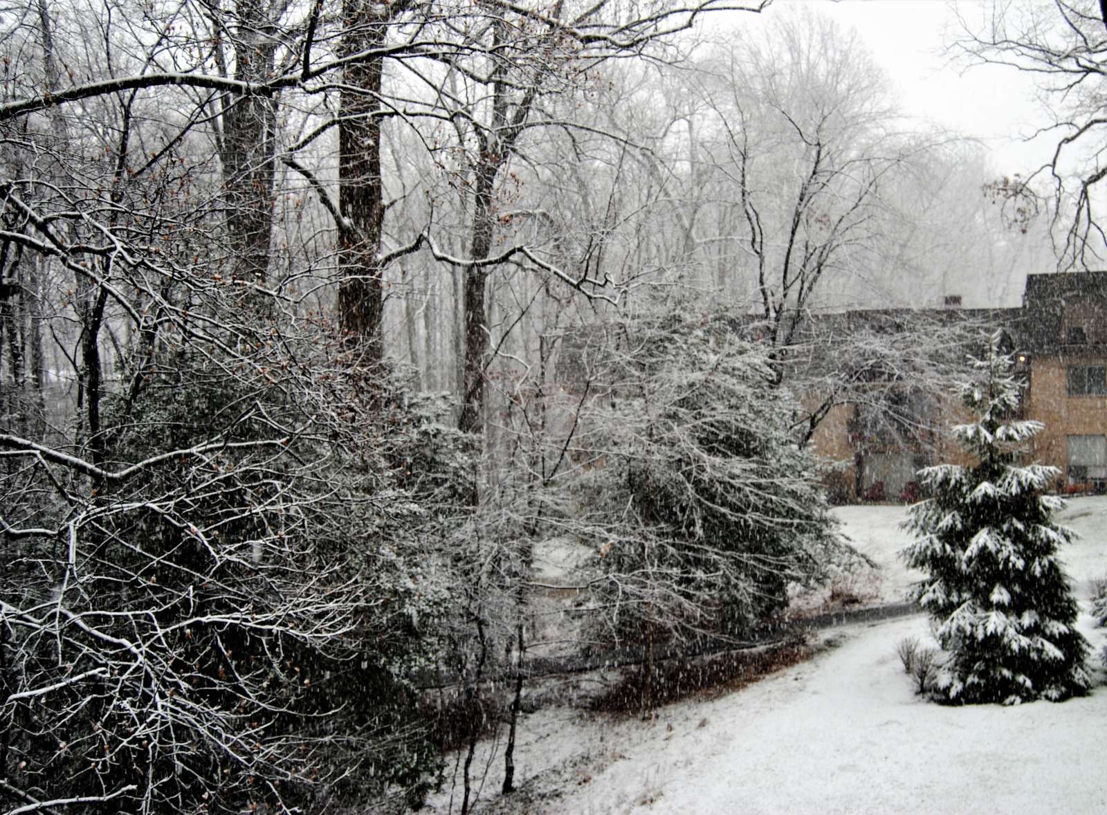
Photo via Doug Errett/Twitter

The D.C. metropolitan area could potentially get its biggest snowfall in two years starting on Sunday (Jan. 31), The Washington Post’s Capital Weather Gang predicts.
The National Weather Service issued a hazardous weather outlook for the region at 10:49 a.m. today. While Northern Virginia is not under a gale warning like Maryland, the agency warns that “there is an enhanced winter storm threat for Sunday and Sunday night, with a slight winter storm threat Monday and Monday night.”
“If the threat materializes, it may cause travel disruptions,” the NWS said.
The current forecast for the Tysons area suggests Saturday night will see clouds set in with a 30% chance of snow or other precipitation after 4 a.m. Chances of precipitation go up to 100% on Sunday, when snow is expected to start falling before 4 p.m. with some freezing rain possibly mixed in.
The NWS forecast suggest snow could continue through Monday with the chance of precipitation still at 50% that night.
As of 9:57 a.m. today, the D.C. area was expected to get three to four inches of snow between 7 p.m. on Saturday and 7 a.m. on Monday.
However, the Capital Weather Gang says this is a “complicated” storm, where total accumulation could vary from two to 12 inches depending on whether a coastal storm forms off the North Carolina coast and brings a second wave on Monday.
In preparation for the weekend, Virginia Department of Transportation crews have been treating roads in Fairfax County and elsewhere in Northern Virginia over the past two days.

A Winter Weather Advisory is in effect for Fairfax County through 9 a.m. tomorrow.
According to the National Weather Service, between one to two inches of snow is possible throughout much of the region.
Here’s more from the NWS alert.
IMPACTS…Plan on slippery road conditions. The hazardous conditions could impact the evening and morning commute.
PRECAUTIONARY/PREPAREDNESS ACTIONS… Slow down and use caution while traveling. When venturing outside, watch your first few steps taken on steps, sidewalks, and driveways, which could be icy and slippery, increasing your risk of a fall and injury.
The Virginia Department of Transportation is asking drivers to avoid slippery roadways.
Closely monitor weather reports for shifts in forecasts in your area.
Plan ahead. If road conditions become hazardous, delay travel for your safety and to give crews time to clear or treat roads.
Be aware of the potential for ice. With freezing temperatures in the forecast, any precipitation may freeze quickly. If you must drive, use extreme caution in areas prone to freezing such as bridges, overpasses, hills, curves, and ramps. See more winter driving tips.
Monitor road conditions from home on www.511virginia.org, on the free mobile app, or call 511 from any phone in Virginia.
Our local @NWS_BaltWash forecast office stresses difficulty level of tonight's forecast while noting it has increased snow amounts for its reasonable worst case scenario – which is what we call a "boom" scenario. pic.twitter.com/7Rap15uRjp
— Capital Weather Gang (@capitalweather) January 25, 2021
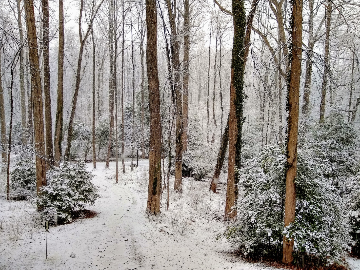
Photo via vantagehill/Flickr

Case Average Takes Downturn — “On Sunday, Virginia recorded 3,792 new coronavirus cases while the seven-day average continues to decline from last week, according to Virginia Department of Health data.” [Reston Patch]
Reston Group Opposes zMOD — The Reston Citizens Association has issued a lengthy statement opposing certain elements of the county’s zoning modernization project. [Reston 2020]
Snow Possible Tonight — “Precipitation breaks out sometime after 3 p.m., probably starting as light rain before changing to a sleet/snow mix. Mixed precipitation will continue to fall lightly through midnight, probably changing back to light rain overnight. High temperatures in the mid- to upper 30s. Accumulations in the D.C. metro area will be mostly confined to grassy surfaces.” [Capital Weather Gang]
Photo by Marjorie Copson
")
Reston Hospital Center Staff Receive COVID-19 Vaccine — Dr. David Adler, an anesthesiologist, was first in line to receive the vaccine at Reston Hospital Center. More than 100 physicians, nurses and caregivers received the vaccine at the hospital so far. [Reston Hospital Center]
Icy Roads and Sidewalks Pose Hazards after Yesterday’s Snow — “So far, between 5:30 and 6:00 a.m., FCFRD has responded to two incidents related to people slipping and falling on ice and injuring themselves. If you must be out this morning, walk with care and caution! Walk like a penguin!” [Fairfax County Fire and Rescue Department]
Metrobus to Operate on Moderate Snow Plan — Metrobus will begin service on its moderate snow service plan, in which some routes will be suspended and detours will be in effect on selected routes. Metro will continue to restore conditions as conditions allow. [Washington Metropolitan Area Transit Authority]
FCPD Launches Community Survey on Search for New Police Chief — Fairfax County has hired POLIHIRE to lead the search for the police chief. The firm is seeking input from the community on key characteristics, skills, traits, and issues to consider. [FCPD]
Photo via vantagehill/Flickr
")
All Fairfax County Public Schools students will learn virtually tomorrow (Wednesday) as the Washington, D.C., metropolitan area braces for its potential first snow of the year.
While the heaviest precipitation is expected to fall more toward the western part of Virginia, the National Weather Service issued a winter weather advisory at 4:00 p.m. today for Fairfax County, predicting that the area will see mixed precipitation with about one to three inches of snow and sleet accumulation.
The advisory will be in effect from 10 a.m. on Wednesday to 1 a.m. on Thursday.
“Plan on slippery road conditions,” the NWS says. “The hazardous conditions could impact the morning or evening commute.”
That forecast is a slight downgrade from the agency’s projections on Monday, when it issued a winter storm watch suggesting that Fairfax County could see more than five inches of snow.
Still, FCPS has decided to close all school buildings to students.
Reston Association Phone Service Restored — After experiencing issues with inbound calls to its member services line, phone service has been restored. [RA]
Snow Days Possible During Virtual Learning — With snow expected on Wednesday and into Thursday, school officials are saying they still anticipate providing “additional approaches” for observing snow days that could include teacher-led and independent learning. Days off are also possible. [Fairfax County Public Schools]
Fairfax County Shelter Offers Safe Adoption — Local police are looking into cases of puppy scams in the area. A spike in the number of pet scams has also been reported. [Reston Patch]
Search Underway for Classroom Monitors — The school system is currently looking to hire temporary classroom monitors. A job description is available online. [FCPS]
Photo via vantagehill/Flickr
")
A Winter Storm Watch has been issued for most of the region, including Fairfax County, on Wednesday.
The National Weather Service says that more than five inches of snow are expected in the area. The watch is in effect from 7 a.m. on Wednesday to 4 a.m. on Thursday.
Here’s more from the alert:
* WHEN…From Wednesday morning through late Wednesday night. Snow will most likely overspread the area later Wednesday morning into Wednesday afternoon. Precipitation may mix with rain and sleet at times later Wednesday afternoon and Wednesday night.
* IMPACTS…Travel could be very difficult to impossible.
PRECAUTIONARY/PREPAREDNESS ACTIONS… Monitor the latest forecasts for updates on this situation.
Photo by Brianna Nelson
")
Local Police Prepare for Winter Storm — The Fairfax County Police Department is preparing for possible snow this Wednesday and Thursday. [FCPD]
Leidos to Buy 1901 Group — “Leidos sees its pending $215 million acquisition of the 1901 Group announced after markets closed Thursday as more capability-focused than a need to add new customers.” [Washington Technology]
National Search Underway for Next FCPD Chief — A national search is underway for the next chief of police. In addition to an online survey, the county will host focus groups with community organizations. [Fairfax County Government]
Photo via vantagehill/Flickr
")
The second snow 2020 may be on its way this weekend. A winter weather advisory is in effect for the area tomorrow (Saturday) from 7 a.m. to 7 p.m.
The National Weather Service says that snow, sleet, and freezing rain is possible.
Here’s more from the alert:
* WHAT…Snow, sleet and freezing rain expected. Total snow and sleet accumulations of up to one inch and ice accumulations of up to one tenth of an inch.
* WHERE…Portions of central Maryland, northern and northwest Virginia and eastern West Virginia.
* WHEN…From 7 AM to 7 PM EST Saturday. Precipitation will begin as snow before transitioning to sleet and freezing rain. Precipitation will change to rain late in the day.
* IMPACTS…Plan on slippery road conditions.
Residents should slow down and exercise caution while traveling.
Photo via NWS
")
General Assembly Convenes Today — “Already, Democrats submitted more than 260 bills for consideration in the upcoming session… It’s been 20 years since the Democrats have had this kind of control in Richmond, but more realistically, those with the kind of progressive values of the current majorities have never come close to running the show in Richmond before.” [Falls Church News-Press]
Topgolf Competitor Seeks Site in Northern Virginia — “Spot Golf is currently in discussions with Billy Casper Golf to construct a venue at 1757 Golf Club.” [Washington Business Journal]
Local Startups Get Top Honors — “Reston-based analytics software developer QOMPLX (fka Fractal Industries) was ranked as fifth-highest and Herndon-based satellite operator HawkEye360 as seventh-highest in a list of “11 D.C. Startup Fundings Above $50 Million in 2019,” compiled by DC Inno.” [Fairfax County Economic Development Authority]
Photo by Philip Lilienthal
")
Today’s snow may bring some welcome news for students wishing for a snow day this week.
Fairfax County Public Schools will closed today (Wednesday). Last night, the schools system planned to open on a two-hour delay.
“The change in FCPS’ operating status for today is due to the hazardous travel conditions that remain in various parts of the county at this hour, especially on secondary roads,” FCPS tweeted earlier this morning.
Photo by Brian Murphy
The first snow of 2020 is blanketing Reston and Herndon with a light cover of snow.
Although no major traffic incidents have been reported, readers should expect a slow afternoon commute today.
Here’s more from social media:
Driving homework assignment 2:
✔️ Slow down and be patient; we're all trying to get somewhere.
✔️ Wipers on? Headlights on.
✔️ Leave room to brake as roads get more slippery. https://t.co/FNvP7NOPAK— Fairfax County Government 🇺🇸 (@fairfaxcounty) January 7, 2020
@RestonNow Reston Parkway in the #snow today pic.twitter.com/EL6ir2Yalu
— WFO (@WFOcom) January 7, 2020
https://twitter.com/MrErrett/status/1214643124372418563?s=20
Be aware and be prepared! Traffic not looking too good out there. If you are driving please drive with care and caution. #FCFRD firefighters/paramedics do not want to meet you by "accident" today! #Snow #traffic ❄️ 🚗 pic.twitter.com/9qavicEb4C
— Fairfax County Fire/Rescue (@ffxfirerescue) January 7, 2020
Photo 1 by Twitter/MrErrett; 2, 3 and 4 by Brian Murphy

With county schools closing two hours early today, the first snow of 2020 is expected to descend on the region.
Although light accumulation of between one to three inches is expected, Reston Now would love to feature your photos of snow in Reston, Herndon and Great Falls.
Send us your photos by emailing us at [email protected]. You can also send them to us via Twitter or Facebook.
We’ll run the best shots later today.