Updated at 8:45 a.m. — The road opened back up sometime before 10 p.m., according to FCPD.
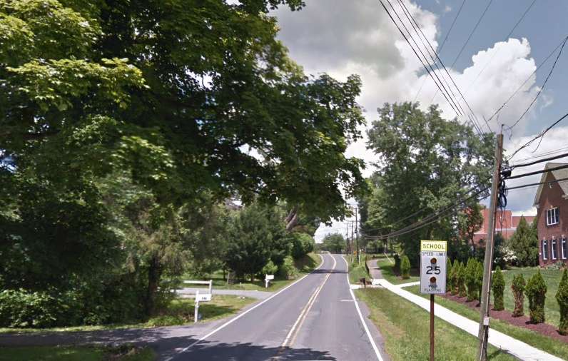
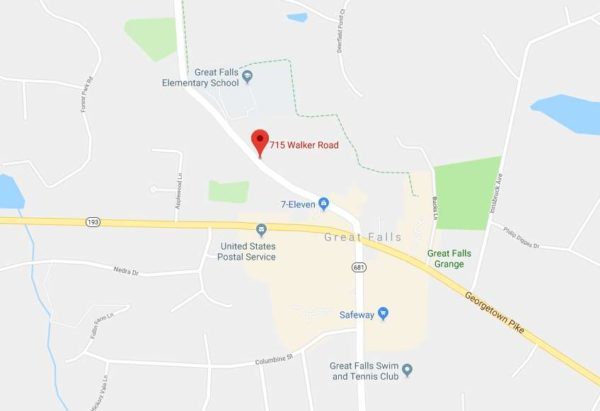
Earlier: A fallen tree at 715 Walker Road currently has the Great Falls road closed as strong winds threaten to create hazards across Fairfax County.
The road in Great Falls is the only one reported for the Reston area in a released list of road closures from the Fairfax County Police Department. FCPD will update the list throughout the day.
The National Weather Service issued a High Wind Warning that is set to last until 6 p.m. tonight (Feb. 25).
More from NWS:
HIGH WIND WARNING IN EFFECT UNTIL 6 PM EST THIS EVENING… The National Weather Service in Baltimore MD/Washington has issued a High Wind Warning, which is in effect until 6 PM EST
this evening. The Wind Advisory is no longer in effect.* TIMING…Strong winds will continue through this afternoon.
* WINDS…West 25 to 35 mph with gusts of 50 to 60 mph. The strongest winds are expected this morning.
* IMPACTS…Damaging winds will blow down trees and power lines. Power outages are expected. Travel will be difficult, especially for high profile vehicles.
Fairfax Fire and Rescue has tips for locals who face issues caused by the sustained winds of 25 to 35 miles per high, with possible gusts up to 60 mph. The fire department wants residents to be mindful of any downed power lines or trees and to use battery powered lighting instead of candles if a power outage occurs.
“It is especially important to understand that downed lines can energize other objects, including fences, cars, trucks, buildings, bushes, trees and telephone and cable TV cables,” according to the post, adding that people should assume that any downed power lines are “live and dangerous.”
Photos via Google Maps

After bouts of snow hit Reston last month, the winter weather is finally on a vacation.
Forecasters expect temperatures to possibly reach 60 degrees for today (Feb. 5), Thursday and Friday in the Reston area.
The warmer weather doesn’t plan to stick around, though.
The Capital Weather Gang tweeted that snow might make a comeback in the D.C.-area on Sunday night. (And while the famous groundhog Punxsutawney Phil predicted an early spring on Feb. 2, meteorologists and statisticians point to his track record of inaccuracies.)
Let us know if your weekday plans are influenced by the forecasts.
File photo

Fairfax County public schools will open two hours late tomorrow (Jan. 31).
FCPS tweeted that tomorrow’s scheduled delay is due to dangerously cold conditions and the potential for icy spots. The county has been hit with snow, rain and gusty winds, this week, causing issues on local roads.
School offices and central offices will open on time tomorrow.
Due to the weather conditions forecast for tomorrow, all Fairfax County public schools will open two hours late, Jan. 31, 2019 (Condition 3B). School offices and central offices will open on time.
— Fairfax Schools 🌟 (@fcpsnews) January 30, 2019
File photo
Update at 8:25 p.m. — Fairfax County Public Schools will be closed Wednesday.
Falling temperatures are expected to create hazardous travel conditions overnight and tomorrow, especially on secondary roads in various parts of the county. As a result, all Fairfax County public schools and offices will be closed Wednesday, Jan. 30, 2019 (Cond. 1).
— Fairfax Schools 🌟 (@fcpsnews) January 30, 2019
Snow accumulation is expected to lessen overnight and the temperature is going to drop. Ice will form on the roadways making driving conditions dangerous. Avoid driving if possible. If you do drive, reduce speeds and stay alert! Ice is difficult to spot. #FCPD pic.twitter.com/PZV6cOTkA8
— Fairfax County Police (@FairfaxCountyPD) January 30, 2019
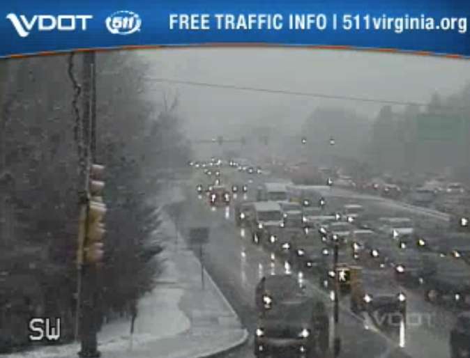
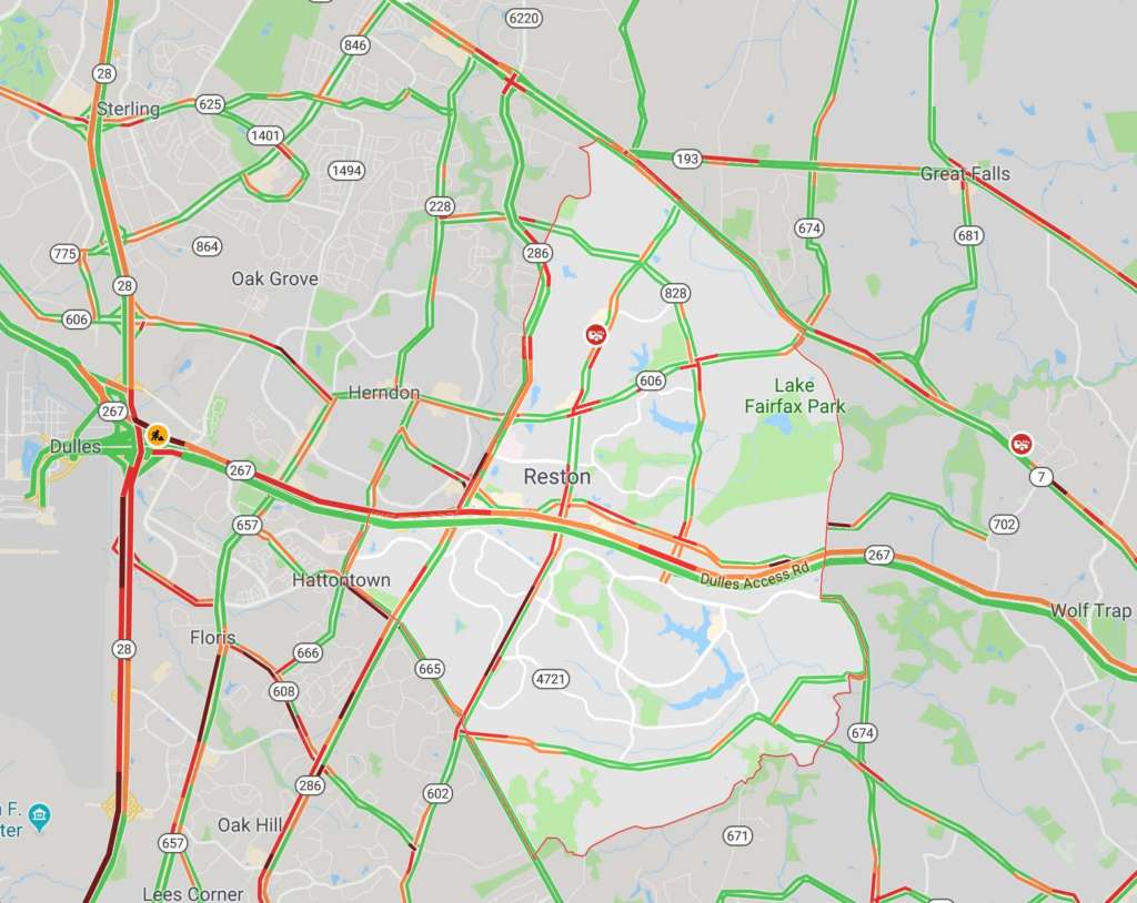
Earlier: Traffic is already starting to back up as commuters head home early to beat expected icy roads from today’s rain and snow.
Traffic is heavy heading westbound on the Dulles Toll Road, according to Google Maps, and drivers should also expect scattered heavy traffic on the Reston Parkway and other primary roads around the area.
A Winter Weather Advisory is currently in effect. Forecasters are warning commuters to be aware of potential travel disruptions and allow for extra time getting back in the evening. Additional problems on the roads are possible Wednesday morning.
From the National Weather Service:
WINTER WEATHER ADVISORY REMAINS IN EFFECT UNTIL MIDNIGHT EST TONIGHT…
* WHAT…Snow, mixed with rain before 5 PM, will turn to all snow by 5 PM this afternoon, and continue through the evening rush before ending between 7 and 9 PM this evening. Total snowfall accumulation around one inch is expected.
* WHERE…Arlington and Fairfax Counties in Virginia, the District of Columbia and its southern and eastern suburbs.
* WHEN…Winter Weather Advisory is in effect until midnight EST tonight.
* ADDITIONAL DETAILS…Plan on slippery road conditions. Temperatures will fall below freezing during the evening rush, causing the potential for wet or slushy surfaces to freeze.
Classes and activities at the Reston Community Center are canceled after 3 p.m. today, and RCC facilities are set to close by 5 p.m. The Reston Association offices also closed at 3 p.m.
Fairfax County public schools closed two hours early today.
Flakes started in the Reston area earlier this afternoon. As of 4 p.m., some local roads were becoming snow-covered.
Looking beautiful in Reston @fox5dc @fox5weather @Reston! ❄️❄️❄️ pic.twitter.com/ENzGSjangc
— Matt Bianco (@BiancoMSB) January 29, 2019
While drivers may not be enjoying the weather right now, at least one furry local is.
https://twitter.com/BranRob79/status/1090322798436847616
Images via Google Maps and Virginia Department of Transportation

It’s the first day of winter — The odds are slim for a snowy Christmas but rain later next week and then a major blizzard may be on the horizon. [Reston Patch]
Drumroll for USA Today’s “Best Holiday Parade” rankings — At noon USA Today will unveil where Reston’s holiday parade fell on this year’s rankings, which are decided by voters. For memories, check out the video below from the Reston Association. [USA Today]
Assistant children’s librarian closes one chapter in her life — Marcia Wine, 71, retired in mid-November from her job at the Reston Regional Public Library. [Reston Connection]
People read these books the most in 2018 — Fairfax County has released the top books checked out of the county’s public libraries. John Green’s “Turtles All the Way Down” and Margaret Atwood’s “The Handmaid’s Tale” made the list. [Fairfax County]
 The National Weather Service (NWS) issued a Flood Watch today (Dec. 20) starting from 7 p.m. Thursday to Friday afternoon for Fairfax and much of the D.C. region.
NWS anticipates widespread rain tonight and showers tomorrow.
NWS expects 1 to 2 inches of rain, but up to 4 inches of rain could fall in local areas.
NWS encourages locals to monitor later forecasts and to stay alert for possible Flood Warnings. Residents should prepare to take action if they live in areas prone to flooding.
More from the National Weather Service:
FLOOD WATCH REMAINS IN EFFECT FROM 7 PM EST THIS EVENING
THROUGH FRIDAY AFTERNOON…The Flood Watch continues for
* Portions of Maryland, The District of Columbia, Virginia, and
West Virginia, including the following areas, in Maryland,
Anne Arundel, Calvert, Carroll, Central and Southeast Howard,
Central and Southeast Montgomery, Charles, Frederick MD,
Northern Baltimore, Northwest Harford, Northwest Howard,
Northwest Montgomery, Prince Georges, Southeast Harford,
Southern Baltimore, St. Marys, and Washington. The District of
Columbia. In Virginia, Albemarle, Arlington/Falls
Church/Alexandria, Augusta, Central Virginia Blue Ridge,
Clarke, Culpeper, Eastern Loudoun, Fairfax, Frederick VA,
Greene, King George, Madison, Nelson, Northern Fauquier,
Northern Virginia Blue Ridge, Orange, Page, Prince
William/Manassas/Manassas Park, Rappahannock, Rockingham,
Shenandoah, Southern Fauquier, Spotsylvania, Stafford, Warren,
and Western Loudoun. In West Virginia, Berkeley, Hampshire,
Hardy, Jefferson, and Morgan.* From 7 PM EST this evening through Friday afternoon
* Widespread rain is expected tonight and showers are expected
Friday. Rainfall amounts around 1 to 2 inches are most likely,
but locally higher amounts around 3 to 4 inches are possible.
Soils remain saturated due to recent rainfall, so excess
runoff from the rain will cause the potential for flooding of
small streams, creeks, and urban areas.
MT @ffxfirerescue: Be aware and prepared! PLEASE remember to NOT drive through a flooded roadway. That includes NOT driving around barriers closing the road! Several folks last week learned the hard way that this is a poor decision. #TurnAroundDontDrown https://t.co/ZhGHwoYiNB
— Fairfax County Government 🇺🇸 (@fairfaxcounty) December 20, 2018
Photo via Bahmad Farzad/Flickr
The National Weather Service issued a Flood Watch today (Dec. 13) from Friday evening to Saturday afternoon for Fairfax and much of the D.C. region.
NWS anticipates 1 to 2 inches of rainfall — possibly up to 3 inches.
NWS encourages locals to monitor later forecasts and to stay alert for possible Flood Warnings.
Residents should prepare to take action if they live in areas prone to flooding.
More from the National Weather Service:
The National Weather Service in Sterling Virginia has issued a
* Flood Watch for portions of Maryland, The District of
Columbia, and Virginia, including the following areas, in
Maryland, Anne Arundel, Calvert, Carroll, Central and
Southeast Howard, Central and Southeast Montgomery, Charles,
Frederick MD, Northern Baltimore, Northwest Harford, Northwest
Howard, Northwest Montgomery, Prince Georges, Southeast
Harford, Southern Baltimore, and St. Marys. The District of
Columbia. In Virginia, Albemarle, Arlington/Falls
Church/Alexandria, Culpeper, Eastern Loudoun, Fairfax, Greene,
King George, Madison, Nelson, Northern Fauquier, Orange,
Prince William/Manassas/Manassas Park, Rappahannock, Southern
Fauquier, Spotsylvania, Stafford, and Western Loudoun.* From Friday evening through Saturday afternoon
* Moderate rainfall is expected with locally heavy rain possible.
Rainfall amounts around 1 to 2 inches are most likely with
locally higher amounts around 3 inches possible. Runoff from the
rainfall may cause creeks and streams to rise out of their
banks as well as the potential for flooding in urban areas.
Heads up! With all of the rain in the forecast the National Weather Service has issued a flood watch for the entire area from 6PM Friday until 6PM Saturday. We will have rain arriving later tomorrow and continuing at times through the weekend w/1-2" total pic.twitter.com/BMwXGIOwS3
— Amelia Draper (@amelia_draper) December 13, 2018
Photo via Bahmad Farzad/Flickr
")
(Updated at 8:10 a.m.)
Fairfax County Public Schools and school facilities will be closed today (Thursday) as a winter weather advisory has been put into effect for Fairfax County. Schools were originally only set for a two hour delay.
From 4 a.m. to 1 p.m. today (Thursday), the National Weather Service is warning residents throughout the Washington, D.C. area to expect up to one inch of sleet and snow, with ice accumulations of up to a tenth of an inch.
NWS says the icy conditions could mean slippery roads and sidewalk conditions in some areas. Here’s more from the NWS alert:
Be very careful if you venture outside tomorrow. Watch your first few steps in particular as your step or path may be coated with ice.
A Winter Weather Advisory means that periods of snow, sleet or freezing rain will cause travel difficulties. Expect slippery
roads and limited visibilities, and use caution while driving.
Fairfax County Government officials remind commuters and residents to take the following precautions as they head out today:
• Make sure your vehicle is ready for winter, checking that your lights, oil, antifreeze, brakes, tires and windshield wipers are in good shape.
• Ensure your headlights are on day or night during inclement weather.
• Leave a few minutes early when driving in inclement weather.
• Keep an eye out for black ice and be aware of potentially icy areas such as bridges.
• Create a safe stopping distance between your car and other vehicles.
• If it does snow, be sure to clear ice and snow from your car’s roof, hood and trunk – and especially from windows, mirrors and lights. Don’t try to drive before your car is defrosted!
Photo via National Weather Service
Update: The tornado watch was canceled around 8:11 p.m. today (September 17), but the National Weather Service still expects heavy rains to continue through the night.
Earlier:
The National Weather Service has issued a tornado watch effective until 10 p.m today (September 17).
Tornadoes are possible as Hurricane Florence’s remnants move past the area.
#Florence has arrived! 🌧 Please be mindful of changing road conditions and remember to use your headlights when using your wipers. #VirginiaLaw pic.twitter.com/FcqTBmZAsR
— Fairfax County Police (@FairfaxCountyPD) September 17, 2018
A tornado watch has been issued for parts of District of Columbia, Maryland and Virginia until 10 PM EDT pic.twitter.com/4CDThHFJfU
— NWS Baltimore-Washington (@NWS_BaltWash) September 17, 2018

ChalkFest at Reston Town Center has been canceled due to Hurricane Florence. The event, which challenges professional artists, amateur artists, businesses, families, and kids of all ages to design chalk drawings, was set to take place on Saturday.
Public Art Reston, which organizes the event, posted the following update about the cancellation earlier today:
With Hurricane Florence approaching the East Coast and the heavy rain predictions we have decided for safety reasons to cancel ChalkFest at Reston Town Center. The event will not be rescheduled.
We wish to thank our sponsors: Reston Town Center, Boston Properties, Reston Community Center, Leidos, Cooley, and Reston Association.
Hurricane Florence is expected to bring between four and eight inches of rain beginning late Thursday and into early Friday. County officials warn that the hurricane could bring potential flooding over the weekend.
“Rain and flooding impacts could last into early next week as flood waters from areas north and west of the county will move our way even after Florence passes. This is a potentially long-term flooding event for Fairfax County, so please pay attention to trusted sources for information,” the county wrote in a statement.
The county is providing sandbags for residents at Reston Regional Library today until 7 p.m. and from 7 a.m. to 7 p.m. tomorrow (Thursday).
File photo
")
‘Dog Days of Summer’ is today — Dogs and their owners can frolic in the pavilion as it’s transformed into an off-leash play area from 4-7 p.m. The dog days of summer event will take place every Wednesday through September 26 at the Reston Town Center pavilion. [Reston Town Center]
Florence is coming — Invited or not, Hurricane Florence continues to barrel its way towards us. Four to eight inches are expected to begin late Thursday into early Friday. Here’s what you need to know to prepare. [Fairfax County Government]
Crime update in Herndon — In early September, Jose Quintanilla Romero, 25, of Herndon, was arrested on five felony accounts of sexual abuse against a victim known to him. In a separate incident, a man said he was robbed by several suspects on September 6 near the 600 block of Center Street around 11 p.m. [Herndon Police Department]
Flickr pool photo by vantagehill
A heat advisory is in effect for Reston and nearby areas from noon to 7 p.m. today.
According to the National Weather Service, heat index values are expected to climb to around 105 degrees and dewpoints are expected to hover in the mid-70s. Heat and humidity could cause heat stress during outdoor exertion or extended exposure.
More from the alert:
A Heat Advisory means that a period of high temperatures is
expected. The combination of high temperatures and high humidity
will create a situation in which heat illnesses are possible.Take extra precautions if you work or spend time outside. When
possible, reschedule strenuous activities to early morning or
evening. Know the signs and symptoms of heat exhaustion and heat
stroke. Wear lightweight and loose fitting clothing when
possible and drink plenty of water.To reduce risk during outdoor work, the Occupational Safety and
Health Administration recommends scheduling frequent rest breaks
in shaded or air-conditioned environments. Anyone overcome by
heat should be moved to a cool and shaded location. Heat stroke
is an emergency – call 911.
Be aware and be prepared. It is going to be HOT! Drink fluids and stay cool. https://t.co/8JfqAfxgOS
— Fairfax County Fire/Rescue (@ffxfirerescue) September 4, 2018
The National Weather Service has issued a flood watch for Reston that is in effect through midnight tonight, ushering in a rainy start to Labor Day Weekend.
Slow-moving thunderstorms are expected to bring showers throughout the region, according to the alert:
FLASH FLOOD WATCH IN EFFECT THROUGH MIDNIGHT EDT TONIGHT… THE NATIONAL WEATHER SERVICE IN STERLING VIRGINIA HAS ISSUED A * FLASH FLOOD WATCH FOR THE DISTRICT OF COLUMBIA, AND PORTIONS OF CENTRAL MARYLAND AND NORTHERN VIRGINIA, INCLUDING THE FOLLOWING AREAS, IN MARYLAND, ANNE ARUNDEL, CARROLL, CENTRAL AND SOUTHEAST HOWARD, CENTRAL AND SOUTHEAST MONTGOMERY, FREDERICK MD, NORTHERN BALTIMORE, NORTHWEST HARFORD, NORTHWEST HOWARD, NORTHWEST MONTGOMERY, PRINCE GEORGES, SOUTHEAST HARFORD, AND SOUTHERN BALTIMORE. IN VIRGINIA, ARLINGTON/FALLS CHURCH/ALEXANDRIA AND FAIRFAX.
* THROUGH MIDNIGHT TONIGHT.
* SLOW MOVING THUNDERSTORMS CAPABLE OF PRODUCING VERY HEAVY RAIN ARE EXPECTED TO DEVELOP THIS AFTERNOON AND EVENING.
* HIGH RAINFALL RATES MAY LEAD TO RAPID RISES OF WATER IN LOW- LYING AND POOR DRAINAGE AREAS AS WELL AS SOME SMALL STREAMS.
PRECAUTIONARY/PREPAREDNESS ACTIONS… A FLASH FLOOD WATCH MEANS THAT CONDITIONS MAY DEVELOP THAT LEAD TO FLASH FLOODING. FLASH FLOODING IS A VERY DANGEROUS SITUATION. YOU SHOULD MONITOR LATER FORECASTS AND BE PREPARED TO TAKE ACTION SHOULD FLASH FLOOD WARNINGS BE ISSUED.
A Flash Flood Watch has been issued for portions of the region until midnight tonight. This includes the Baltimore and Washington metropolitan areas. pic.twitter.com/xvRwqNUIua
— NWS Baltimore-Washington (@NWS_BaltWash) August 31, 2018
 A severe thunderstorm warning is in effect for Fairfax County until 3 p.m., according to the National Weather Service.
Wind gusts of up to 60 miles per hour are possible. Damaging winds may cause trees and large branches to fall. Localized power outages are also possible.
Residents are encouraged to remain indoors and avoid areas where trees may be downed due to damaging winds.
Severe Thunderstorm Warning including Linton Hall VA, South Riding VA, Chantilly VA until 3:00 PM EDT pic.twitter.com/ljINfVXExi
— NWS Severe Tstorm (@NWSSevereTstorm) June 19, 2018
A flash flood watch is in effect from 2 p.m. through late tonight (May 31). Between two and four inches of rain are expected to fall in the area.
A Flash Flood Watch has been posted today for much of the region (dark green). Focus will be I-81 today & metro corridor tonight. Be prepared to seek higher ground should flooding develop. Don't drive through flooded roadways, as this is a leading cause of death due to floods. pic.twitter.com/0qIxwixsXf
— NWS Baltimore-Washington (@NWS_BaltWash) May 31, 2018
The National Weather Service issued the following alert earlier today:
* NUMEROUS SHOWERS AND THUNDERSTORMS CAPABLE OF PRODUCING HEAVY RAINFALL ARE EXPECTED TO APPROACH THE REGION THIS AFTERNOON AND CONTINUE PAST MIDNIGHT. LOCALIZED RAINFALL AMOUNTS OF 2 TO 4 INCHES ARE EXPECTED.
* RAPID RISES OF CREEKS AND STREAMS WILL BE POSSIBLE DUE TO TORRENTIAL RAINFALL, POTENTIALLY SPILLING BEYOND THEIR BANKS. IN ADDITION, LOW POINTS ALONG ROADWAYS MAY BECOME IMPASSIBLE DUE TO ACCUMULATING RUNOFF. FLASH FLOODING MAY DEVELOP QUICKLY.
PRECAUTIONARY/PREPAREDNESS ACTIONS… A FLASH FLOOD WATCH MEANS THAT CONDITIONS MAY DEVELOP THAT LEAD TO FLASH FLOODING. FLASH FLOODING IS A VERY DANGEROUS SITUATION. YOU SHOULD MONITOR LATER FORECASTS AND BE PREPARED TO TAKE ACTION SHOULD FLASH FLOOD WARNINGS BE ISSUED.