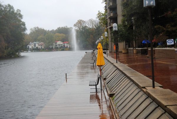
If you’ve stepped or looked outside this afternoon, it will likely come as no surprise that a wind advisory has been issued for Fairfax County and the rest of the D.C. area.
Sent out at 2:47 p.m., the National Weather Service says that the advisory will be in effect until 8 p.m., with wind gusts potentially reaching up to 50 miles per hour.
Here are the details from the full alert:
…WIND ADVISORY IN EFFECT UNTIL 8 PM EDT THIS EVENING…
* WHAT…Northwest winds 15 to 20 mph with gusts up to 50 mph expected.
* WHERE…Portions of The District of Columbia, central and southern Maryland and northern Virginia.
* WHEN…Until 8 PM EDT this evening.
* IMPACTS…Gusty winds could blow around unsecured objects. Tree limbs could be blown down and a few power outages may result.
“Use extra caution when driving, especially if operating a high profile vehicle,” the NWS said. “Secure outdoor objects.”
[4/21 at 3 PM] A Wind Advisory is in effect until 8 PM this evening.
💨 15-20 mph winds with gusts up to 50 mph
🗑️Secure outside objects (trash cans, recycling bins, etc.)
🔌 Keep electronic devices charged in case of any power outages#ReadyFairfax #WindSafety #VaWx pic.twitter.com/acr61450l3— Ready Fairfax (@ReadyFairfax) April 21, 2021
Dense Fog Advisory in Effect — The advisory is one effect through 11 a.m. today. Drivers should slow down, use headlights and leave plenty of distance between vehicles. [National Weather Service]
County Reiterates Need for Testing — The county is encouraging residents to get tested in order to perform case investigations and identify close contacts — a move that prevents the spread of COVID-19. A new strain is circulating in the United States that could be 50 percent more contagious. [Fairfax County Government]
Red Cross Blood Drives Coming to Reston Soon –The American Red Cross is hosting several blood drives in the area, including one on April 2 at the YMCA in Reston. A second blood drive is planned on April 5 at Herndon Ward LDS. [Reston Patch]
County Launches Parks Storytelling Project — ‘The Park Authority’s Healthy Strides program is launching a new storytelling project called “I Love Parks” — the theme of the annual 5K/10K/Kids Dash scheduled for Saturday, May 1, 2021. Share how parks have affected your life over this past year of pandemic shutdowns by submitting a photo and your story. Your experience could become part of a slideshow that will be showcased on the Park Authority’s website and on social media.’ [Fairfax County Government]
Photo via vantagehill/Flickr
Fire Watch In Effect — A fire weather watch is in effect today from noon to 5 p.m. The National Weather Service notes that breezy winds, low humidity and dry conditions can cause fires to spread rapidly. [Ready Fairfax]
County 9-1-1 Service Officially Restored — The county’s 9-1-1 line is running smoothly again. Most of the day on Wednesday, call capacity was limited and callers experienced longer wait times. [Fairfax County Government]
The Top Ten Percent — Ten percent of Virginians are officially fully vaccinated and more than two million doses have been administered throughout the state, according to state data. Older adults have the most vaccine doses among age groups. [Reston Patch]
Metro Dodges Service Cuts — The passage of the American Recovery Plan will help Metro avert major service cuts and layoffs. However, the direct impact of the passage of the federal relief package is still unclear. Metro’s Board of Directors chairman notes that it is not yet known how much Metro will receive. [Washington Metropolitan Area Transit Authority]
Photo via vantagehill/Flickr
The National Weather Service issued a Winter Weather Advisory at 8:43 a.m. today for much of the D.C. area, including Fairfax County.
Precipitation started falling early this morning and could result in up to an inch of snow accumulation. The alert will remain in effect until 3 p.m.
Here is the full alert:
…WINTER WEATHER ADVISORY IN EFFECT UNTIL 3 PM EST THIS AFTERNOON…
* WHAT…Rapid onset of snow which will result in snow covered roadways. Snow accumulations of up to one inch.
* WHERE…Portions of central and northern Maryland and northern Virginia.
* WHEN…Until 3 PM EST this afternoon.
* IMPACTS…Plan on slippery road conditions. The hazardous conditions will impact the morning or evening commute.
“Slow down and use caution while traveling,” the NWS said. “When venturing outside, watch your first few steps taken on steps, sidewalks, and driveways, which could be icy and slippery, increasing your risk of a fall and injury.”
[2/22/21 @ 8:50 AM] A Winter Weather Advisory is now in effect until 3 PM this afternoon. Expect snow accumulations of up to 1 inch that will result in snow covered roads. Slow down & use caution when driving. Also, beware of icy sidewalks & steps! #FFXSnow #WinterWeather pic.twitter.com/E18QdmjcE2
— Ready Fairfax (@ReadyFairfax) February 22, 2021
Snow (graupel) is falling in Vienna, VA and a quick dusting has already accumulated @capitalweather @ABC7Brian @MikeTFox5 pic.twitter.com/wbgSWhmgAS
— Brendan Pham (@WXStormGeek) February 22, 2021
Photo by Jessica Fadel on Unsplash
The D.C. area is hunkered down for another winter storm today (Thursday) that could last into Friday morning.
At 1:05 p.m., the National Weather Service downgraded its earlier winter storm warning to a Winter Weather Advisory. As of 8:30 this morning, the NWS had projected one to three inches of snow, a drop down from previous forecasts of three to six inches of accumulation.
However, with the addition of freezing rain and ice, the roads are still going to be slippery, making travel a challenge.
In previous years, icy road conditions would have made for treacherous commutes to work and school, but the novel coronavirus pandemic has forced many to work and learn from home. Still, the frequency of winter weather events over the past few weeks can feel disruptive, even if not much snow has actually materialized so far this year.
How do you feel about all this winter weather? Do you wish there was more snow, or are you comfortable with the amount that Fairfax County has gotten? Are you ready for warmer weather yet?
Photo via Fairfax County Police Department
Local closures are in effect today as snow continues to fall in the Reston area today.
A Winter Storm Warning is in effect through early Friday morning, with the possibility of three to six inches o of snow and one-tenth t one-quarter inch of ice is also expected.
Fairfax County government offices and courts are closed today and all employees have been given emergency leave.
The Fairfax Connector will operate a on holiday weekend service schedule. If road conditions get worse, service may be reduced further.
All Fairfax County Public Schools and central officers are also closed today. In-person and virtual learning is also canceled.
Today’s school board meeting will take place virtually at 7 p.m.
Here’s more from the Fairfax County Department of Transportation on recent changes.
Routes 231, 232, 335, 351, 393, 394, 395, 396 422, 432, 461, 494, 495, 556, 585, 599, 624, 634, 697, 698, 699, 722, 724 and 985, which will not operate.
Route 980 will run every 12-15 minutes instead of every 6-8 minutes.
Passengers are encouraged to check the status of routes online before heading to a bus stop. If a bus is on detour, the county’s BusTracker will not reflect real-time estimated arrival information.
The county has also cancelled all COVID-19 vaccine clinics administered directly the Fairfax County Health Department for today. Residents will receive an email with a re-registration link for the upcoming week.
Reston Association’s member services office is also closed for appointments today. Members can call or email RA for more information.
You know the drill: #StayHome and stay OFF the roads, friends. Ice, snow, and sleet are impacting many parts of #Virginia. Remember, it's nearly impossible to travel safely in icy conditions. Be safe! #VaWx pic.twitter.com/45FC096FKK
— Virginia Department of Emergency Management (@VDEM) February 18, 2021
Photo by Marjorie Copson
The D.C. metropolitan area, including Fairfax County, could get up to six inches of snow in a storm expected to arrive early tomorrow (Thursday) morning.
The region is now under a Winter Storm Warning, a step up from the Winter Storm Watch that the National Weather Service issued yesterday afternoon.
Issued at 10:24 a.m., the warning will take effect at 3 a.m. on Thursday and stay in place until 6 a.m. Friday. The NWS says there will be heavy snow mixed with sleet and freezing rain, forecasting three to six inches of snow and one-tenth to one-quarter inch of ice accumulation.
More details from the alert are below:
* WHEN…From 3 AM Thursday to 6 AM EST Friday. Snow will begin between 3 and 5 AM. Snow will change to a mixture of sleet and freezing rain during the late morning and early afternoon hours.
* IMPACTS…Power outages and tree damage are likely due to the ice. Travel could be nearly impossible. The hazardous conditions could impact the morning or evening commute.
* ADDITIONAL DETAILS…Snow Thursday morning will be heavy at times with snowfall rates around 1 to 2 inches per hour possible along with visibility reduced to around one-quarter mile at time.
Warning that the storm is expected to have “significant road impacts,” the Virginia Department of Transportation is advising residents to prepare to stay home and avoid nonessential travel tomorrow and on Friday.
VDOT says its crews are finishing pretreatment of about 2,000 lane miles of interstates and primary roads in Northern Virginia. About 3,000 pieces of equipment will be ready tonight to treat roads, and plowing will start once two inches of snow have accumulated.
“Additional equipment and crews are on standby to report, including to handle downed trees or limbs from ice,” VDOT said in a news release.
The Fairfax County Fire and Rescue Department suggests testing smoke and carbon monoxide alarms to ensure they work, charging cell phones and tablets, and using a flashlight or other battery-powered device if power goes out.
Photo by Doug Errett
More snow is expected later this week.
The National Weather Service has issued a Winter Storm Watch for most of the region from late Wednesday night through late Thursday night.
Snow accumulations of five or more inches and total ice accumulations of more are possible.
More from the alert is below.
IMPACTS…Power outages and tree damage are likely due to the ice. Travel could be nearly impossible. The hazardous conditions could impact the morning or evening commute.
PRECAUTIONARY/PREPAREDNESS ACTIONS… Monitor the latest forecasts for updates on this situation.
Winter Storm Watches have been issued for the entire region for heavy wintry precipitation starting late Wednesday night and continuing through Thursday night. Visit https://t.co/ZOlvESgJ2H for more details. #DCwx #MDwx #VAwx #WVwx pic.twitter.com/ieYFLd2lqL
— NWS Baltimore-Washington (@NWS_BaltWash) February 16, 2021
Photo by Marjorie Copson
A Winter Storm Watch is in effect for the region this weekend.
The National Weather Service says that heavy ice is possible from Saturday morning through Sunday morning.
More from the alert is below.
* WHAT…Heavy icing possible. Total snow accumulations of up to one inch and ice accumulations of one quarter of an inch possible.
* WHERE…The District of Columbia, portions of central and southern Maryland and northern Virginia.
* WHEN…From Saturday morning through Sunday morning.
* IMPACTS…Power outages and tree damage are possible due to the ice. Travel could be nearly impossible.
PRECAUTIONARY/PREPAREDNESS ACTIONS… Monitor the latest forecasts for updates on this situation.
A Winter Storm Watch has been issued for Saturday and Saturday night for locations where significant icing from freezing rain is most likely. Outside of the watch, lesser amounts of ice will still likely result in travel difficulties. Check the latest at https://t.co/5RyZgoXicj pic.twitter.com/HxZ9M2tUNd
— NWS Baltimore-Washington (@NWS_BaltWash) February 11, 2021
Photo by Marjorie Copson
Prepare for more snow in the region later tonight and into tomorrow.
The National Weather Service has issued a Winter Weather Advisory for most of the region. The advisory is in effect from 7 p.m. today through 10 a.m. tomorrow.
NWS expects snow accumulations of between one to three inches. More from the alert is below.
IMPACTS…Plan on slippery road conditions. The hazardous conditions could impact the morning or evening commute.
PRECAUTIONARY/PREPAREDNESS ACTIONS… Slow down and use caution while traveling.
When venturing outside, watch your first few steps taken on steps, sidewalks, and driveways, which could be icy and slippery increasing your risk of a fall and injury.
Winter Weather Advisories are now up for much of the area for tonight's winter storm. Generally looking at 2 to 4 inches of snow across the advisory area, with a light glaze of ice expected across central VA. pic.twitter.com/fIMrJu6rbB
— NWS Baltimore-Washington (@NWS_BaltWash) February 10, 2021
Winter Weather Advisory for Fairfax County beginning tonight(2-10) at 7 PM and ending Thursday at 10 AM. Currently 1 – 3 inches are expected. Be aware and be prepared. Remain weather aware and monitor updates throughout the day. #FCFRD #FFXSnow #WinterWeather #weather pic.twitter.com/8UMoNpuk74
— Fairfax County Fire/Rescue (@ffxfirerescue) February 10, 2021
Photo by Marjorie Copson
More snow may be on way as the previous week’s storm melts away.
The National Weather Service has issued a Winter Storm Watch for most of the region. The watch is in effect from late Saturday night through Sunday afternoon.
Heavy snow with total accumulations of five or more inches is possible.
More from the alert is below.
* WHERE…THE DISTRICT OF COLUMBIA, AND PORTIONS OF CENTRAL AND SOUTHERN MARYLAND, NORTHERN VIRGINIA, AND EASTERN WEST VIRGINIA.
* WHEN…FROM LATE SATURDAY NIGHT THROUGH SUNDAY AFTERNOON.
* IMPACTS…PLAN ON SLIPPERY ROAD CONDITIONS.
PRECAUTIONARY/PREPAREDNESS ACTIONS… MONITOR THE LATEST FORECASTS FOR UPDATES ON THIS SITUATION
Photo by Doug Errett
Fairfax County and much of the region could see up to nine inches through tomorrow.
The National Weather Service issued a winter storm warning for the region last night. Snow accumulations between four and nine inches are expected.
The Virginia Department of Transportation is urging residents to avoid unnecessary travel during today’s storm.
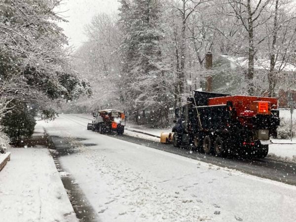
So far, crews are treating roads and will begin to plow snow once it accumulates throughout the day.
“With more than 3,000 pieces of equipment, crews will work around the clock on state-maintained roads, focusing on clearing roads that carry the most traffic first. These include interstates, primary roads, and routes connecting public safety and emergency services. Crews can then focus on neighborhoods and lower-volume roads,’ VDOT wrote in a statement earlier this morning.”
Here’s more from NWS:
…WINTER STORM WARNING REMAINS IN EFFECT FROM 1 AM SUNDAY TO MIDNIGHT EST SUNDAY NIGHT…
* WHAT…HEAVY SNOW EXPECTED. SNOW ACCUMULATIONS THROUGH SUNDAY NIGHT AROUND 3 TO 6 INCHES WITH ICE ACCUMULATIONS AROUND ONE TENTH OF AN INCH.
* WHERE…THE WASHINGTON METROPOLITAN AREA.
* WHEN…FROM 1 AM SUNDAY TO MIDNIGHT EST SUNDAY NIGHT. SNOW WILL OVERSPREAD THE AREA BETWEEN 3 AND 5 AM EARLY SUNDAY MORNING. THE STEADIEST SNOW WILL FALL THROUGH SUNDAY AFTERNOON BEFORE TAPERING OFF TO AN INTERMITTENT MIX OF LIGHT SNOW, SLEET, AND FREEZING RAIN. ADDITIONAL SNOW IS EXPECTED MONDAY THROUGH MONDAY NIGHT WITH ADDITIONAL ACCUMULATIONS MOST LIKELY AROUND 1 TO 3 INCHES, BRINGING THE STORM TOTAL ACCUMULATIONS AROUND 4 TO 8 INCHES.
* IMPACTS…TRAVEL WILL BE VERY DIFFICULT SUNDAY THROUGH TUESDAY MORNING DUE TO A PROLONGED PERIOD OF SNOW AND WINTRY PRECIPITATION WITH TEMPERATURES NEAR OR BELOW FREEZING.
PRECAUTIONARY/PREPAREDNESS ACTIONS…
IF YOU MUST TRAVEL, KEEP AN EXTRA FLASHLIGHT, FOOD, AND WATER IN YOUR VEHICLE IN CASE OF AN EMERGENCY.
WHEN VENTURING OUTSIDE, WATCH YOUR FIRST FEW STEPS TAKEN ON STEPS, SIDEWALKS, AND DRIVEWAYS, WHICH COULD BE ICY AND SLIPPERY, INCREASING YOUR RISK OF A FALL AND INJURY.
VDOT also issued the following tips for residents
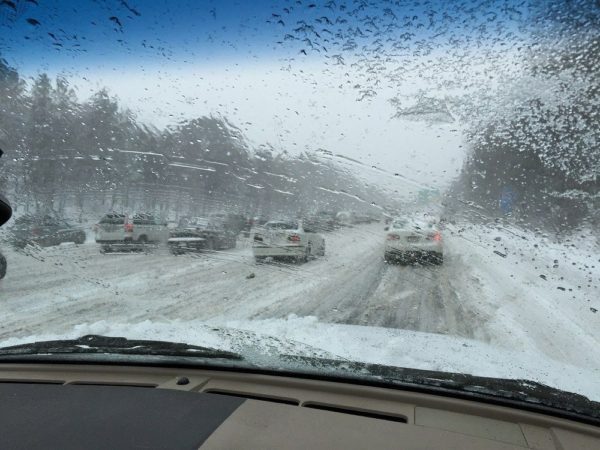
Stay home and avoid driving throughout the storm. Heavy snow bands will mean reduced visibility and potential for conditions to deteriorate quickly. Should the higher end of forecasts materialize, it will take some time to make a passable lane on all roads.
Park in driveways or a single side of the street to allow a wider path for plows.
View tips on shoveling driveways, as the plows will push some snow back. Take frequent breaks, especially when shoveling heavy, wet snow.
If you absolutely must travel, completely clear your car, reduce speeds significantly and use these winter driving tips. Use extreme caution on areas prone to freezing such as bridges, ramps and overpasses. Be prepared with gas and wiper fluid tanks and an emergency kit.
Monitor road conditions and traffic cameras from home on www.511virginia.org, on the free mobile app, or call 511 in Virginia.
Follow @vadotnova and @NWS_BaltWash for real-time updates. Learn more about snow removal at virginiadot.org/snow and stats for Northern Virginia.
Roads are slick as snow continues to fall. Please use caution and if possible, stay home! #FCPD pic.twitter.com/ppRbDMinUz
— Fairfax County Police (@FairfaxCountyPD) January 31, 2021
Photo via Doug Errett/Twitter
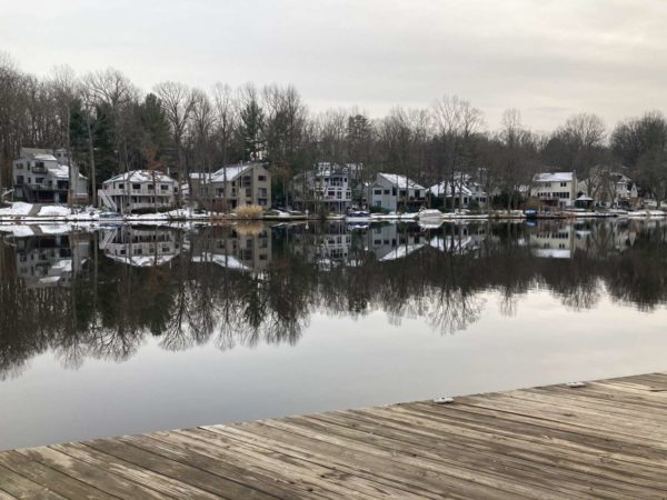
The D.C. metropolitan area could potentially get its biggest snowfall in two years starting on Sunday (Jan. 31), The Washington Post’s Capital Weather Gang predicts.
The National Weather Service issued a hazardous weather outlook for the region at 10:49 a.m. today. While Northern Virginia is not under a gale warning like Maryland, the agency warns that “there is an enhanced winter storm threat for Sunday and Sunday night, with a slight winter storm threat Monday and Monday night.”
“If the threat materializes, it may cause travel disruptions,” the NWS said.
The current forecast for the Tysons area suggests Saturday night will see clouds set in with a 30% chance of snow or other precipitation after 4 a.m. Chances of precipitation go up to 100% on Sunday, when snow is expected to start falling before 4 p.m. with some freezing rain possibly mixed in.
The NWS forecast suggest snow could continue through Monday with the chance of precipitation still at 50% that night.
As of 9:57 a.m. today, the D.C. area was expected to get three to four inches of snow between 7 p.m. on Saturday and 7 a.m. on Monday.
However, the Capital Weather Gang says this is a “complicated” storm, where total accumulation could vary from two to 12 inches depending on whether a coastal storm forms off the North Carolina coast and brings a second wave on Monday.
In preparation for the weekend, Virginia Department of Transportation crews have been treating roads in Fairfax County and elsewhere in Northern Virginia over the past two days.
A Winter Weather Advisory is in effect for Fairfax County through 9 a.m. tomorrow.
According to the National Weather Service, between one to two inches of snow is possible throughout much of the region.
Here’s more from the NWS alert.
IMPACTS…Plan on slippery road conditions. The hazardous conditions could impact the evening and morning commute.
PRECAUTIONARY/PREPAREDNESS ACTIONS… Slow down and use caution while traveling. When venturing outside, watch your first few steps taken on steps, sidewalks, and driveways, which could be icy and slippery, increasing your risk of a fall and injury.
The Virginia Department of Transportation is asking drivers to avoid slippery roadways.
Closely monitor weather reports for shifts in forecasts in your area.
Plan ahead. If road conditions become hazardous, delay travel for your safety and to give crews time to clear or treat roads.
Be aware of the potential for ice. With freezing temperatures in the forecast, any precipitation may freeze quickly. If you must drive, use extreme caution in areas prone to freezing such as bridges, overpasses, hills, curves, and ramps. See more winter driving tips.
Monitor road conditions from home on www.511virginia.org, on the free mobile app, or call 511 from any phone in Virginia.
Our local @NWS_BaltWash forecast office stresses difficulty level of tonight's forecast while noting it has increased snow amounts for its reasonable worst case scenario – which is what we call a "boom" scenario. pic.twitter.com/7Rap15uRjp
— Capital Weather Gang (@capitalweather) January 25, 2021
Photo via vantagehill/Flickr
A Flash Flood Watch is in effect for most of the area on Christmas Eve tomorrow.
The watch will remain in effect from Thursday afternoon through late Friday night.
Here’s more from the National Weather Service on the alert.
* ONE AND HALF TO TWO AND HALF INCHES OF RAIN ARE EXPECTED THURSDAY AFTERNOON AND THURSDAY NIGHT. THIS IS EXPECTED TO RESULT IN FLASH FLOODING OF SMALL STREAMS AND CREEKS AND POSSIBLE RIVER FLOODING
Photo via vantagehill/Flickr


