
Winter Weather Advisory In Effect — A Winter Weather Advisory is in effect for the area until noon today. Light, mixed precipitation is possible and snow accumulations of up to one inch are expected. [National Weather Service]
Reston Men Charged in Vehicle Pursuit — “An officer attempted to stop a 2007 Ford Focus for a traffic violation. The driver initially pulled over but then drove away, resulting in a pursuit. The driver, Chris Kpadeh, 20, of Reston, stopped down the road and was taken into custody. He was charged with reckless driving, speed to elude, and driving on a suspended license. A passenger, Mohamed Abdalla, 21, of Reston, was charged with two counts of possession of a concealed weapon and possessing a magazine for a firearm with the capacity of 20+ rounds.“ [Fairfax County Police Department]
No Snow Day Today — All county schools will take part in virtual learning today. Students will follow their regular Monday schedule for virtual instruction. [Fairfax County Public Schools]
Deadline for Reston Association Assessments Approaches — Members have until March 1 to pay their 2021 assessment. Installment plans are also available. [RA]
Photo via vantagehill/Flickr

A Winter Weather Advisory is in effect for Fairfax County through 9 a.m. tomorrow.
According to the National Weather Service, between one to two inches of snow is possible throughout much of the region.
Here’s more from the NWS alert.
IMPACTS…Plan on slippery road conditions. The hazardous conditions could impact the evening and morning commute.
PRECAUTIONARY/PREPAREDNESS ACTIONS… Slow down and use caution while traveling. When venturing outside, watch your first few steps taken on steps, sidewalks, and driveways, which could be icy and slippery, increasing your risk of a fall and injury.
The Virginia Department of Transportation is asking drivers to avoid slippery roadways.
Closely monitor weather reports for shifts in forecasts in your area.
Plan ahead. If road conditions become hazardous, delay travel for your safety and to give crews time to clear or treat roads.
Be aware of the potential for ice. With freezing temperatures in the forecast, any precipitation may freeze quickly. If you must drive, use extreme caution in areas prone to freezing such as bridges, overpasses, hills, curves, and ramps. See more winter driving tips.
Monitor road conditions from home on www.511virginia.org, on the free mobile app, or call 511 from any phone in Virginia.
Our local @NWS_BaltWash forecast office stresses difficulty level of tonight's forecast while noting it has increased snow amounts for its reasonable worst case scenario – which is what we call a "boom" scenario. pic.twitter.com/7Rap15uRjp
— Capital Weather Gang (@capitalweather) January 25, 2021
Photo via vantagehill/Flickr
")
Tomorrow is the first day of March, yet wintry weather is making a comeback to the D.C. area as spring nears.
Locals in Reston and Herndon can expect 1 to 3 inches of snow and sleet later tonight and tomorrow morning.
The National Weather Service issued a Winter Weather Advisory that will last until 10 a.m. tomorrow.
More from NWS:
…WINTER WEATHER ADVISORY IN EFFECT FROM 10 PM THIS EVENING TO 10 AM EST FRIDAY…
* WHAT…Snow and sleet expected. Total snow and sleet accumulations of 1 to 3 inches expected.
* WHERE…The District of Columbia, portions of central and southern Maryland and northern and northwest Virginia.
* WHEN…From 10 PM this evening to 10 AM EST Friday.
* ADDITIONAL DETAILS…Plan on slippery road conditions. The hazardous conditions could impact the morning commute.
The Virginia Department of Transportation said in a snow update this afternoon that crews are pretreated roads throughout northern Virginia and will have crews staged along roads tonight.
VDOT asks that drivers to prepare ahead for impacts to the morning rush hour and to closely monitor the weather.
Here are some additional details for the expected winter weather moving into our region tonight into Friday morning. pic.twitter.com/ecluXqXZv8
— NWS Baltimore-Washington (@NWS_BaltWash) February 28, 2019
Photo via @billwhe67/Twitter
Updated at 4:45 p.m. — Fairfax County Public Schools announced that schools will open two hours late tomorrow (Feb. 21). School offices and central offices will open on time.
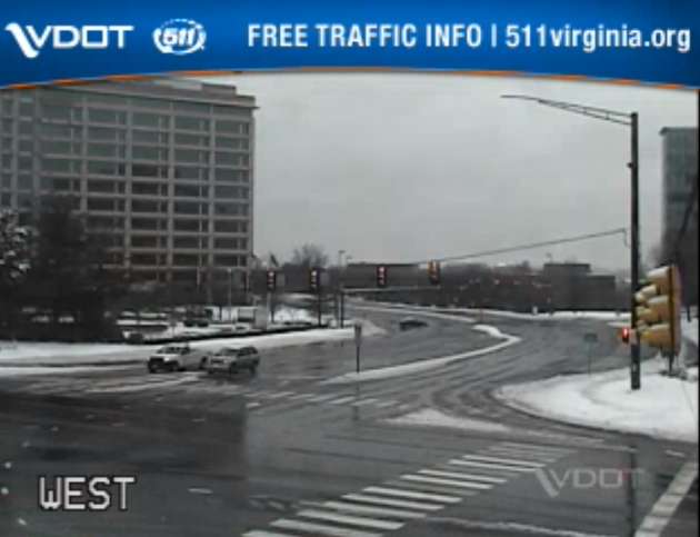
Earlier: Major roads appear clearer and mostly without traffic this afternoon, yet public safety officials keep asking locals to stay off of the roadways.
An emergency post from Fairfax County said that a number of traffic accidents took place today (Feb. 20) around the county. With sleet and rain recently replacing the snow, locals can expect slippery roads, the National Weather Service warns.
Herndon and Reston saw around 4.5 inches of total snow accumulation, according to NWS.
With the majority of the snow now changed over to sleet/ freezing rain, attention is turned to ice accumulations as temperatures only gradually warm above freezing. Advisories & Warnings continue through the evening, with the greatest ice accumulations north/west of I-95. pic.twitter.com/uNqXPPgPyB
— NWS Baltimore-Washington (@NWS_BaltWash) February 20, 2019
Several locals posted photos noting the change this afternoon from snow to a wintry mix of sleet and rain.
Sleet eroding snow in Reston @capitalweather pic.twitter.com/b7xIVFUUNr
— Bill Burton (@burtonwc) February 20, 2019
Looks like we are at around 4” in Reston @capitalweather – mostly sleet coming down at this point. pic.twitter.com/DKiM3TlzwD
— C. G. Niederstrasser (@RocketScient1st) February 20, 2019
https://twitter.com/hollyweatherwax/status/1098248450783760385
A Winter Weather Advisory is in effect for the county and surrounding area until 10 p.m. for snow, sleet and ice.
More from NWS:
WHAT…Mixed precipitation. Additional snow and sleet
accumulations of less than one inch through mid afternoon, then
ice accumulations of up to one tenth of an inch through 10 pm.
All freezing rain is expected to transition to rain by 10 pm.* WHERE…Portions of central and northern Virginia.
* WHEN…Until 10 PM EST this evening.
* ADDITIONAL DETAILS…Plan on slippery road conditions. The
hazardous conditions will impact the evening commute.PRECAUTIONARY/PREPAREDNESS ACTIONS…
A Winter Weather Advisory means that periods of snow, sleet or
freezing rain will cause travel difficulties. Expect slippery
roads and limited visibilities, and use caution while driving.When venturing outside, watch your first few steps taken on
steps, sidewalks, and driveways, which could be icy and slippery,
increasing your risk of a fall and injury.
The weather has prompted some event cancellations tonight in Reston and Herndon.
Images via Virginia 511, Google Maps and Marjorie Copson
")
Updated at 6:55 a.m. — FCPS will be closed Friday.
Fairfax County Public Schools announced the closures this morning. School offices and central offices will open two hours late.
All Fairfax County public schools will be closed today, Feb. 1, 2019. School offices and central offices will open 2 hours late, to be opened by 10 a.m. (Condition 5) with an unscheduled leave policy in effect for 12-month employees.
— Fairfax Schools 🌟 (@fcpsnews) February 1, 2019
6:51 am: Snow continues to develop locally. A new batch forming right over the city lately.
It may take a while to reach the ground thanks to dry air but it’ll stick immediately once it does. Take it slow out there! pic.twitter.com/nyPAVC9owc
— Capital Weather Gang (@capitalweather) February 1, 2019
Earlier: Fairfax County Public Schools are taking no chances amid forecasts calling for a burst of snow during the Friday morning commute.
FCPS will open two hours late tomorrow, the school system announced Thursday night.
Due to the winter weather advisory in effect tomorrow, all Fairfax County public schools and school offices will open two hours late Friday, Feb. 1, 2019 (Condition 3A). Central offices will open by 10:00 a.m.
— Fairfax Schools 🌟 (@fcpsnews) January 31, 2019
The National Weather Service has issued a Winter Weather Advisory for the area.
…WINTER WEATHER ADVISORY IN EFFECT FROM 6 AM TO 3 PM EST FRIDAY… * WHAT…SNOW IS LIKELY. SNOW ACCUMULATION LESS THAN ONE INCH. THE BEST CHANCE FOR SNOW WILL BE BETWEEN 7 AM AND NOON FRIDAY. * WHERE…THE WASHINGTON METROPOLITAN AREA. * WHEN…FROM 6 AM TO 3 PM EST FRIDAY. * ADDITIONAL DETAILS…WITH SURFACE TEMPERATURES WELL BELOW FREEZING FRIDAY MORNING, EVEN MINOR ACCUMULATIONS OF SNOW COULD CAUSE UNTREATED ROADS TO BECOME ICY. PRECAUTIONARY/PREPAREDNESS ACTIONS… DRIVERS SHOULD PREPARE FOR ICY TRAVEL FRIDAY MORNING, AND PLAN FOR EXTRA TIME TO TRAVEL. WHILE IT IS NOT CERTAIN THAT SNOW ACCUMULATION AND ICY TRAVEL WILL DEVELOP AT THIS TIME, THE POTENTIAL THREAT IS THERE. PLAN AHEAD. THE LATEST ROAD CONDITIONS FOR THE STATE YOU ARE CALLING FROM CAN BE OBTAINED BY CALLING 5 1 1. &&
VDOT is asking drivers to proceed with caution Friday morning.
VDOT asks that drivers be alert to potential wintry weather that may impact commutes Friday morning. Light snow and extremely low temperatures may cause icy conditions.
Crews continue working overnight to treat roads for refreeze from earlier this week, and will also be staged tomorrow morning to treat roads for more light snow.
Photo by Twitter user @MrErrett
Update at 8:25 p.m. — Fairfax County Public Schools will be closed Wednesday.
Falling temperatures are expected to create hazardous travel conditions overnight and tomorrow, especially on secondary roads in various parts of the county. As a result, all Fairfax County public schools and offices will be closed Wednesday, Jan. 30, 2019 (Cond. 1).
— Fairfax Schools 🌟 (@fcpsnews) January 30, 2019
Snow accumulation is expected to lessen overnight and the temperature is going to drop. Ice will form on the roadways making driving conditions dangerous. Avoid driving if possible. If you do drive, reduce speeds and stay alert! Ice is difficult to spot. #FCPD pic.twitter.com/PZV6cOTkA8
— Fairfax County Police (@FairfaxCountyPD) January 30, 2019
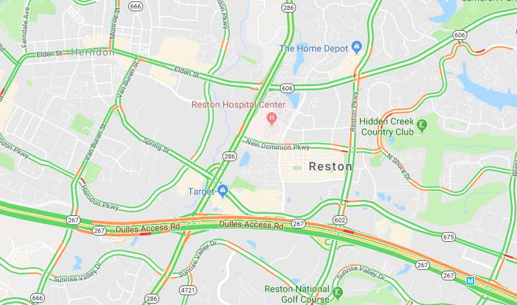
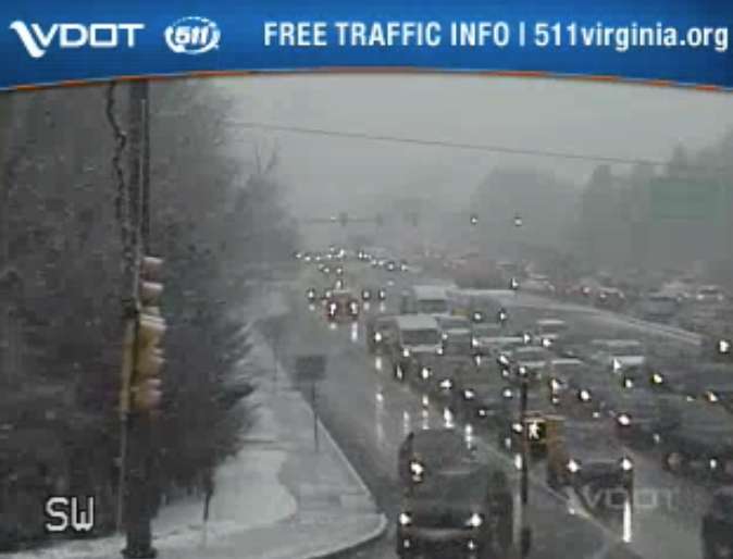
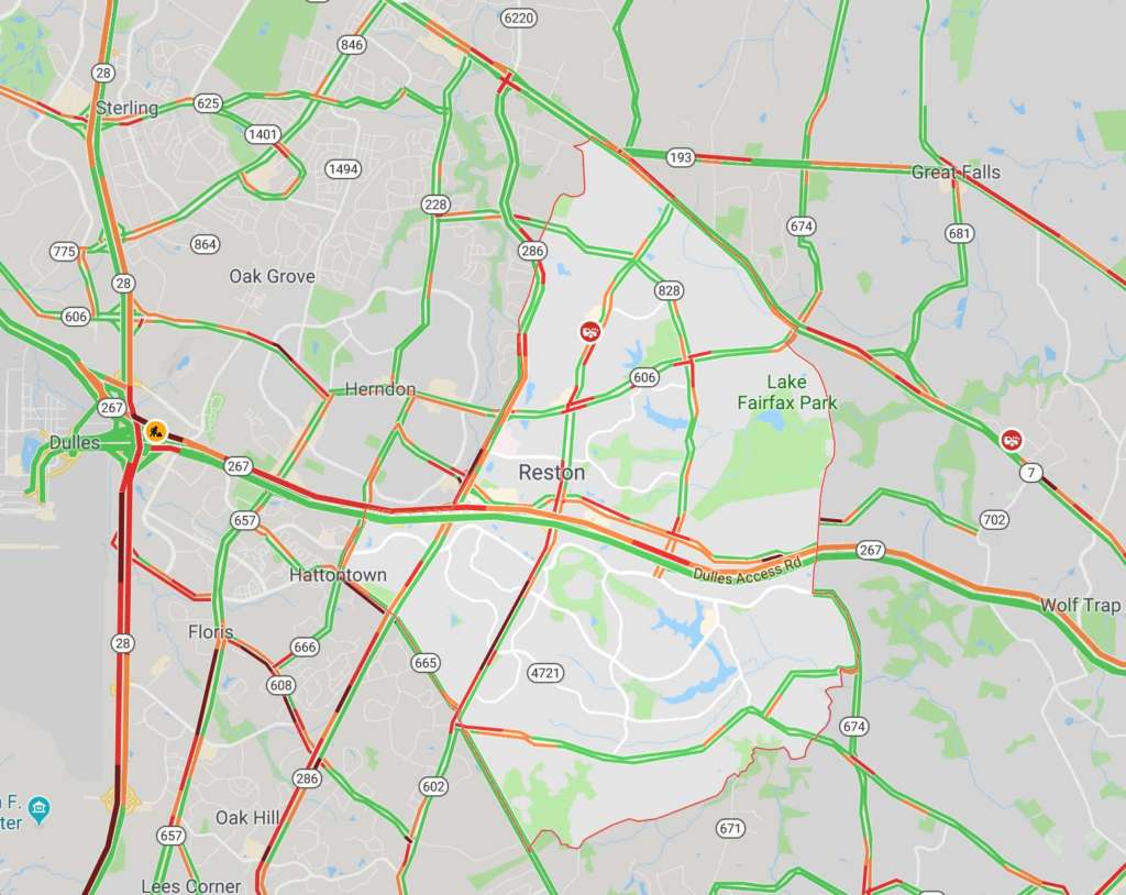
Earlier: Traffic is already starting to back up as commuters head home early to beat expected icy roads from today’s rain and snow.
Traffic is heavy heading westbound on the Dulles Toll Road, according to Google Maps, and drivers should also expect scattered heavy traffic on the Reston Parkway and other primary roads around the area.
A Winter Weather Advisory is currently in effect. Forecasters are warning commuters to be aware of potential travel disruptions and allow for extra time getting back in the evening. Additional problems on the roads are possible Wednesday morning.
From the National Weather Service:
WINTER WEATHER ADVISORY REMAINS IN EFFECT UNTIL MIDNIGHT EST TONIGHT…
* WHAT…Snow, mixed with rain before 5 PM, will turn to all snow by 5 PM this afternoon, and continue through the evening rush before ending between 7 and 9 PM this evening. Total snowfall accumulation around one inch is expected.
* WHERE…Arlington and Fairfax Counties in Virginia, the District of Columbia and its southern and eastern suburbs.
* WHEN…Winter Weather Advisory is in effect until midnight EST tonight.
* ADDITIONAL DETAILS…Plan on slippery road conditions. Temperatures will fall below freezing during the evening rush, causing the potential for wet or slushy surfaces to freeze.
Classes and activities at the Reston Community Center are canceled after 3 p.m. today, and RCC facilities are set to close by 5 p.m. The Reston Association offices also closed at 3 p.m.
Fairfax County public schools closed two hours early today.
Flakes started in the Reston area earlier this afternoon. As of 4 p.m., some local roads were becoming snow-covered.
Looking beautiful in Reston @fox5dc @fox5weather @Reston! ❄️❄️❄️ pic.twitter.com/ENzGSjangc
— Matt Bianco (@BiancoMSB) January 29, 2019
While drivers may not be enjoying the weather right now, at least one furry local is.
https://twitter.com/BranRob79/status/1090322798436847616
Images via Google Maps and Virginia Department of Transportation

The county’s public schools and offices are set to close two hours early on Tuesday (Jan. 29) as incoming wintery weather may create hazardous road conditions.
Fairfax County Public Schools tweeted shortly after 5 p.m. today (Jan. 28) that the decision is “due to the anticipated snow and freezing rain in the forecast tomorrow afternoon and evening, and the possibility of deteriorating travel conditions.”
The National Weather Service said an abrupt transition from rain to about 1 to 3 inches of snow could likely create poor driving conditions.
Commuters are encouraged to be aware of potential travel disruptions and allow for extra time getting back in the evening.
Due to the anticipated snow and freezing rain in the forecast tomorrow afternoon and evening, and the possibility of deteriorating travel conditions, all Fairfax County public schools and offices will close two hours early Tuesday, Jan. 29, 2019 (Cond 4). https://t.co/zNBBMjWGwr
— Fairfax Schools 🌟 (@fcpsnews) January 28, 2019
File photo

Rain and snow are slated to hit Fairfax County tomorrow, possibly making roads slick from sudden weather changes.
The National Weather Service recently posted a Winter Weather Advisory at 2:58 p.m. today for Fairfax County and nearby areas beginning tomorrow.
NWS expects rain and snow late in the afternoon and early evening on Tuesday (Jan. 29). NWS anticipates about 1 to 3 inches of snow, with the abrupt transition from rain to snow creating poor driving conditions.
Commuters are encouraged to be aware of potential travel disruptions and allow for extra time getting back in the evening.
The advisory says the following:
WINTER WEATHER ADVISORY IN EFFECT FROM NOON TO 10 PM EST
TUESDAY…* WHAT…Any rain will change to snow during the afternoon hours.
Total snow accumulations of 1 to 3 inches expected.* WHERE…Portions of central and northern Maryland and northern
Virginia.* WHEN…From noon to 10 PM EST Tuesday.
* ADDITIONAL DETAILS…Plan on slippery road conditions. The
hazardous conditions will impact the evening commute.
Temperatures will fall well below freezing during the evening,
causing any moisture or slush to freeze on untreated surfaces.PRECAUTIONARY/PREPAREDNESS ACTIONS…
A Winter Weather Advisory for snow means periods of snow will
cause primarily travel difficulties. Expect snow covered roads
and limited visibilities, and use caution while driving.The latest road conditions for the state you are calling from can
be obtained by calling 5 1 1
From @NWS_BaltWash: If you plan on commuting Tuesday evening, be aware of the potential for travel disruptions. Plan ahead by allowing for extra travel time, and consider using public transportation and telework options. More details: https://t.co/zZL89SPjAy pic.twitter.com/3EfguqmsRi
— Fairfax County Government 🇺🇸 (@fairfaxcounty) January 28, 2019
Be prepared for an impacted Tues PM commute. Snow is forecast to hit around that time. Be aware that temps will drop (freezing) and the winds will pick up. Pls plan to leave work or be home a little early. Clear the roads so we can clear the roads. #teamwork pic.twitter.com/TuDjXbw29S
— VDOT Northern VA (@VaDOTNOVA) January 28, 2019
File photo

With an inch of snow anticipated tonight and tomorrow, activities at Fairfax County public schools or on school grounds are canceled for this afternoon and evening.
FCPS wrote in a tweet today (Jan. 17) that the “expected wintry weather in our area tonight” prompted the decision.
The School Age Child Care Program will remain open until 6:15 p.m. tonight.
Due to the expected wintry weather in our area later today, all activities scheduled in Fairfax County public schools or on school grounds for this afternoon and evening, Jan. 17, are canceled (Cond 6) https://t.co/zNBBMkehnZ
SACC centers will remain open until 6:15 p.m.— Fairfax Schools 🌟 (@fcpsnews) January 17, 2019
File photo
")
(Updated at 8:10 a.m.)
Fairfax County Public Schools and school facilities will be closed today (Thursday) as a winter weather advisory has been put into effect for Fairfax County. Schools were originally only set for a two hour delay.
From 4 a.m. to 1 p.m. today (Thursday), the National Weather Service is warning residents throughout the Washington, D.C. area to expect up to one inch of sleet and snow, with ice accumulations of up to a tenth of an inch.
NWS says the icy conditions could mean slippery roads and sidewalk conditions in some areas. Here’s more from the NWS alert:
Be very careful if you venture outside tomorrow. Watch your first few steps in particular as your step or path may be coated with ice.
A Winter Weather Advisory means that periods of snow, sleet or freezing rain will cause travel difficulties. Expect slippery
roads and limited visibilities, and use caution while driving.
Fairfax County Government officials remind commuters and residents to take the following precautions as they head out today:
• Make sure your vehicle is ready for winter, checking that your lights, oil, antifreeze, brakes, tires and windshield wipers are in good shape.
• Ensure your headlights are on day or night during inclement weather.
• Leave a few minutes early when driving in inclement weather.
• Keep an eye out for black ice and be aware of potentially icy areas such as bridges.
• Create a safe stopping distance between your car and other vehicles.
• If it does snow, be sure to clear ice and snow from your car’s roof, hood and trunk – and especially from windows, mirrors and lights. Don’t try to drive before your car is defrosted!
Photo via National Weather Service

A mix of snow, sleet and freezing rain is in the forecast for Fairfax County and the surrounding areas beginning late tonight and lasting through tomorrow morning, according to a winter weather advisory issued by the National Weather Service today.
The wintry precipitation is slated to come between midnight and noon Saturday. Snow and sleet are expected to come first, followed by freezing rain early Saturday morning. The precipitation likely will change to rain by noon.
Snow and sleet accumulation of less than one inch is possible, making roads and walkways slippery.
File photo via Twitter/George Mesthos
 It’s March, but there is still time for some more winter.
The National Weather Service has issued a Winter Weather Advisory for Reston and the rest of the Washington, DC, area from 10 p.m. Thursday to 10 a.m. Friday.
Precipitation will move in initially as a rain and snow mix early this evening before transitioning to all snow late tonight. Snow is expected overnight impacting the morning commute. Snow is expected to taper off by midday Friday. Total accumulation: one to three inches, says the NWS.
A winter weather advisory for snow means that periods of snow will cause travel difficulties including slippery roads resulting in hazardous travel conditions. This could affect your Friday morning commute.
Light snow at Lake Anne/file photo
 The National Weather Service has issued a Winter Weather Advisory for Reston, Fairfax County and most of Northern Virginia from 10 p.m. Monday through Tuesday night.
Snow is heading here, with accumulations of 1 to 3 inches. Locally higher amounts are expected North and West of D.C.
The weather will begin as a mixture of rain and snow Monday night, turning to all snow after midnight. Periods of snow will continue into Tuesday, the NWS said.
The Virginia Department of Transportation (VDOT) is urging commuters to plan ahead for Tuesday morning’s commute.
VDOT says c rews have treated interstates and major roads in Fairfax and surrounding counties with brine and liquid magnesium chloride in advance of the snow. About 1,450 trucks will pre-deploy Monday night along interstates, main roads and neighborhood streets. They will remain on duty to plow and treat roads through the day Tuesday, says VDOT
More from the NWS:
EXPECT SNOW COVERED ROADS AND TRAVEL DISRUPTIONS.
WINDS…NORTH 5 TO 10 MPH.
TEMPERATURES…IN THE LOWER TO MIDDLE 30S.
PRECAUTIONARY/PREPAREDNESS ACTIONS…
A WINTER WEATHER ADVISORY FOR SNOW MEANS THAT PERIODS OF SNOW WILL CAUSE PRIMARILY TRAVEL DIFFICULTIES. BE PREPARED FOR SNOW COVERED ROADS AND LIMITED VISIBILITIES…AND USE CAUTION WHILE DRIVING.
Reston Now will keep you up to date on any school delays or closings, as well as road conditions.