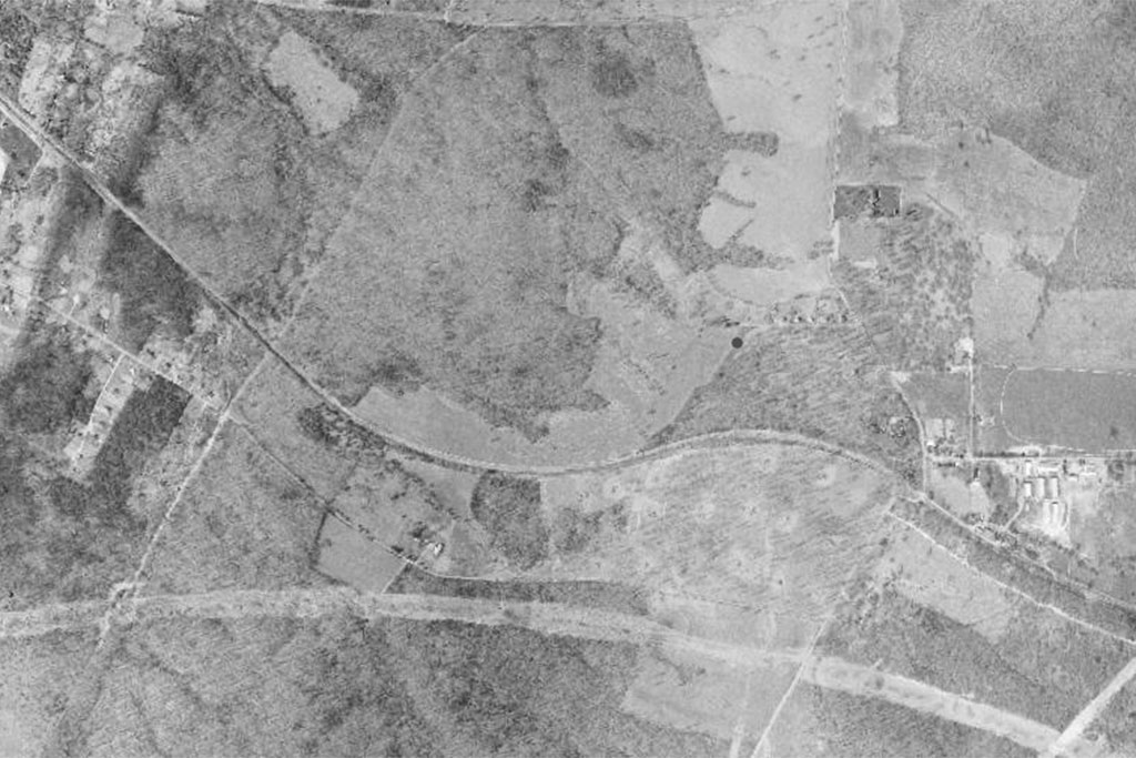
If there’s an area that represents the opposite of the sleepy, village-style Lake Anne, it’s the Reston Town Center. Like we did with Lake Anne, Reston Now has used the Fairfax County’s Historic Imagery Viewer to put together aerial views of Reston Town Center as it has developed over the years.
Like much of Reston, aerial photography of the site up to 1960 shows open forest or farmland. However, while the rest of Reston started being developed and growing throughout the 1960s, the Reston Town Center would remain forest until the Mobil Land Development group began construction in 1988.
Photography from 1990 shows the very beginnings of the town center — a handful of central buildings at the main square surrounded mostly by parking lots to the west.
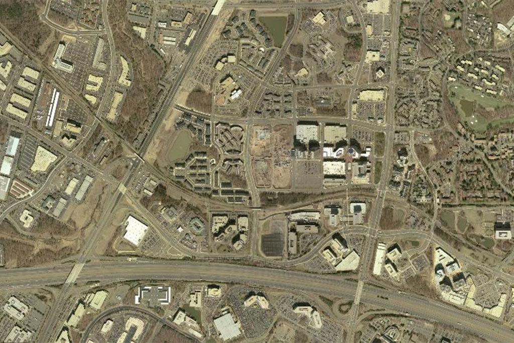
Throughout the 1990s, more buildings are constructed at the northern end of the site, but it isn’t until around 2002 that the Town Center fully expands to the Fairfax County Parkway in the west and the Dulles Access Road in the south.
A big park of this expansion is the creation of the West Market neighborhood at the western edge of the development. In 1993 the open pavilion, currently an ice-skating rink, was built and in 2000 the 18-story One Freedom Square and 16-story Two Freedom Square west of the main plaza were constructed.
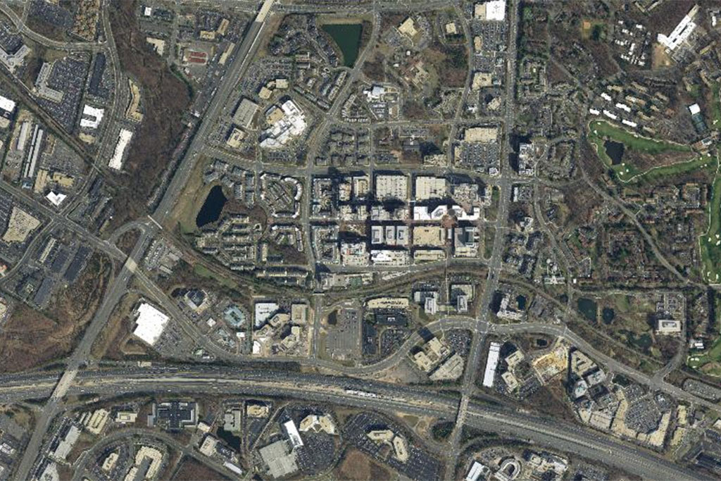
From 2002 to 2017, most of the new development is filling out the spaces between the larger developments. Throughout the 2000s a parking garage and additional office and high-rise residential buildings were also constructed.
Much of the newer development is concentrated at the southern part of the Town Center along Sunset Hill Road, near where the Reston Town Center Metro station is scheduled to open in 2020.
Recent Stories

Owners of six Woofie’s franchises in Northern Virginia are hosting a “Paws in the Park” pet adoption event tomorrow (Saturday) at Wolf Trap National Park. Participating Woofie’s include Reston/Herndon, Ashburn-Leesburg,…

A Fairfax Connector bus to Tysons (staff photo by James Jarvis) The Fairfax County Department of Transportation (FCDOT) has the green light to apply for a federal grant to replace…

The splash pad at the Mosaic District in Merrifield has been turned on (staff photo by Angela Woolsey) Congress Approves More National Airport Flights — “More long-haul flights are coming…

Fairfax County’s annual Summer Entertainment Series will kick off on June 1 (via Fairfax County Park Authority/Twitter) The Fairfax County Park Authority has composed a slate of summer shows, including…