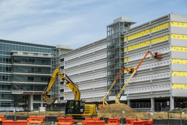
Renaissance Park, a 60-acre property near Dulles International Airport, could be transformed into a series of data centers.
RP Industrial Owner LLC is seeking the county’s permission to replace warehouse buildings in the industrial park with roughly 2.3 million gross square feet of data centers and an electric substation. The park is located east of Park Center Road and north of Towerview Drive.
The application, which was submitted to the county on Sept 3, calls for four data center buildings. Two loading docks for each data center are proposed and roughly 685 parking spaces are planned on the property. Roughly 27 percent of the park will remain as open space.
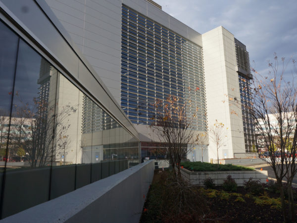
The first phase of construction will begin with one building, a guardhouse and an electric substation. Later phases will begin in response to market conditions, according to the application. The first building, which is 91 feet in height, will be constructed with what the applicants describe as a “contemporary style” with a mix of pre-cast concrete panels, metal, and glass.
RP Industrial Owner LLC bought the site in June 2019 for $134 million, according to county land records. The LLC is linked to Starwood Property Trust, which is based in Connecticut.
A growing number of data centers have established their hold in Northern Virginia, notably in Loudoun and Prince William counties. According to a 2020 report by the Northern Virginia Technology Council, the region is the largest data center market in the world. As of last year, there are 166 data centers in Northern Virginia, including 27 in Fairfax County.
No public hearings have been scheduled for the proposal yet, which was only accepted for review earlier this month.

Community Raises Money for Family of Hit-and-Run Victim — A GoFundMe started on Friday (Sept. 3) by the sister of Reston resident Andrew Willingham, who was killed in a hit-and-run incident on Fairfax County Parkway last week, has received more than $257,000 as of 7:30 p.m. yesterday (Wednesday). The money will go toward helping Willingham’s wife and two sons with expenses, including a future college fund. [Patch]
County Launches Data Hub for Reston Parks — “You can now access the latest information on urban parks and athletic fields associated with redevelopment in the Reston Transit Station Areas through the new Urban Parks Activity Hub. The new online hub is one of three components of the Reston Data Visualization project created by the Department of Planning and Development in coordination with the Park Authority.” [Fairfax County Government]
Herndon Police Chief With Rare State Award — “Chief [Maggie] DeBoard and Executive Director Dana Schrad were recognized by the Virginia Association of Chiefs of Police & Foundation with the 2021 Outstanding Contribution to Law Enforcement Award…This award recognizes an individual’s conspicuous act or achievement in the performance of their duty that results in an exceptional and responsible contribution to the law enforcement profession here in VA.” [Herndon Police/Twitter]
Reston Contractor CEO Recalls Company’s 9/11 Origins — Reston-based defense technology contractor EverWatch Corp. CEO John Hillen says his life “is very oddly wrapped up with 9/11.” His experience in downtown New York City on Sept. 11, 2001 propelled him from Wall Street to the State Department under the George W. Bush administration, and his company now provides tools for defense missions that directly stem from the attacks. [Washington Business Journal]
Photo via vantagehill/Flickr
Reston has seen a noticeable uptick in development over the past half-decade, just as local officials hoped with the arrival of Metro’s Silver Line, but between the multitude of projects and their often similar names, it’s understandable if residents have lost track of what buildings are going up where.
Fairfax County has come up with a solution, introducing an online map that shows the status and location of zoning projects in the Reston Transit Station Areas (TSAs).
Launched Wednesday (July 28), the Zoning Activity Data Hub is the second part of a larger Reston Data Visualization Project that the Fairfax County Department of Planning and Development has been working on to make it easier for community members to track development and infrastructure changes in the area.
“The project is the first of its kind for Fairfax County,” the county said in a news release. “It focuses on enhancing data transparency associated with Reston development and infrastructure improvements, including information about mobility, parks, and zoning activity.”
Planning department leaders and the Hunter Mill District supervisor’s office came up with the idea for the data visualization project when the county’s Comprehensive Plan for Reston was amended in February 2014 to establish the TSAs, according to DPD Urban Centers Section Chief Suzie Battista.
“Staff committed to increasing the public accessibility of planning data and trends,” Battista said by email. “This transparency allows citizens to better understand project timing and planning directions.”
The county released the first phase of the project in January with the launch of a Reston Transportation Data Hub, which has information about road projects, transit routes, and amenities for bicyclists and pedestrians.
The zoning hub features all proposed and approved zoning applications submitted to the county in the Wiehle-Reston East, Reston Town Center, and Herndon Metro station areas since February 2014.
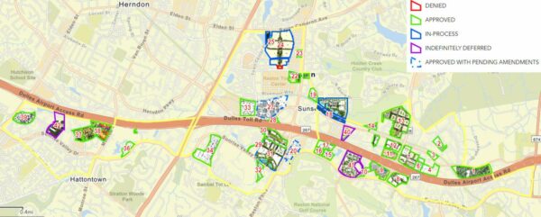
Each project is outlined in a different color depending on whether the application has been approved, denied, indefinitely deferred, or is in process. The arrow by the project name leads to links to images of the site and the application documents.
While the map is currently static, county planners told the Fairfax County Board of Supervisors in May that the data hubs will eventually be equipped to illustrate how Reston has changed over time.
Battista says the zoning activity hub will be updated “on an as-needed basis, such as when substantial zoning case are revised or new zoning applications are approved.”
The county says an Urban Parks Hub will be added to the data project “in the coming months.”
The proliferation of development around Reston comes despite repeated delays of the Silver Line Phase 2 project, which will extend Metro to Reston Town Center, Herndon, and into Loudoun County.
Hunter Mill District Supervisor Walter Alcorn calls the zoning data hub “a big step forward” in providing transparency.
“Reston has millions of square feet of development with approved zoning that has not yet been built,” Alcorn said in a statement. “…These online tools are a step toward visualizing what the transit station areas (TSA) of Reston will look like if all the development that has been approved is actually built.”
Reston residents will soon be able to track changes in the area’s land and urban development over time.
Fairfax County launched an interactive Reston Transportation Hub in January as the start of the Reston Data Visualization project. The hub features data about vehicle, pedestrian, bicycle, and public transit developments.
“This will help us capture changes over time,” Beth Elliot, an urban centers section planner for the Department of Planning and Development, told the Fairfax County Board of Supervisors during a land use policy committee meeting yesterday (Tuesday).
Right now, the dashboard only features one year of data — specifically, from 2019.
“But in the future, as we add additional data, you’ll be able to see how it’s progressed and where changes have occurred,” Elliot said.
Since its release, the Reston Data Visualization project has continued to evolve as more data becomes available and put into the digital system. Elliot says the planning department hopes to release additional sections of the project in the “next few months.”
“With this tool, our goal is to move towards an interactive format which allows us to present more data than a static format would provide, and utilize current technology compared to a printed document,” Elliot told the board. “We also hope this will allow us to have users access the data they’re specifically interested in, compared to, say, a 200-page report where you’re flipping through trying to figure out which page you care about.”
The additional phases to be rolled out include applications that present information for zoning activity and urban parks in Reston.
Elliot added that the department is planning to develop the Tysons Annual Report into an interactive platform, starting with an upcoming publication in October, as the department coordinates with the agencies responsible for putting together the progress report.
“I have to say, in the month and a half or so since I was briefed on this, it just keeps getting better,” Hunter Mill District Supervisor Walter Alcorn said. “Data is added, and I think this has quite an upside over the years and as data becomes available.”
A new bill could potentially significantly limit how long the Fairfax County Police Department and other state police departments can store data obtained through automated license plate readers (ALPRs).
As originally written, SB 1198 would bar police from storing data obtained by ALPRs for more than 30 days without a warrant or ongoing active investigation.
ALPRs have the ability to collect data and information like photos of license plates as well as a driver’s location at a particular date and time. They are often mounted on street poles, overpasses, or police square cars while a central server houses the data.
A number of civil liberty organizations like the ACLU have come out against the use of ALPRs as an invasion of privacy and chilling First Amendment protected activity.
The Virginia State Supreme Court ruled late last year that police departments are allowed to keep this data “indefinitely,” no warrant or investigation needed. This came after a Fairfax County judge ruled otherwise in 2019, saying that it was in violation of Virginia’s “Data Act.”
While some jurisdictions do purge this data relatively quickly, the Fairfax County Police Department does not.
Reston Now has confirmed that FCPD stores information collected by ALPRs for up to a year.
Their reasoning is that the information helps protect the community and locate missing persons.
“Using technology such as license plate recognition has improved our ability to safeguard Fairfax County,” Anthony Guglielmi, FCPD spokesperson, told Reston Now in a statement. “With that, we have stringent systems in place to protect the information privacy and constitutional rights of those we serve. We appreciate efforts to further study this important issue because it’s paramount that we strike an equitable balance between data retention and investigational integrity.”
The state bill was introduced by State Senator Chap Petersen who represents the 34th district, which covers Fairfax, Vienna, Oakton, and parts of Chantilly.
He introduced a similar bill back in 2014 and 2015, which limited storage of data to only seven days. That 2015 bill, which did have bipartisan support, was vetoed by Governor Terry McAuliffe.
“License plate readers… capture the movement of vehicles. They track who’s attending a church service, who’s attending a political rally, a gun show,” Petersen tells Reston Now. “It can be very arbitrary and very dangerous in that… it’s used to essentially put a layer of surveillance over citizens who are exercising their constitutional rights.”
The bill also notes that opportunities to secure employment, insurance, credit, and the right to due process could be “endangered by the misuse of certain of these personal information systems.”
That being said, Petersen notes his bill does not stop the collecting of this information but rather simply adds a “limitation” – 30 days – on how long information of this nature can be stored.
Additionally, the 30-day limitation is dropped if a warrant is obtained or there’s active criminal or missing person investigation.
“Frankly, it’s a pretty modest requirement,” he says.
Petersen says it’s this lack of “guardrails” that worry him and why he’s continued to propose bills of this nature.
“They say they have all types of internal controls. But who’s the judge of that?,” he says. “Who the heck knows who has access and who doesn’t. It’s the ability to use this [information] arbitrability or prejudicially that we have no control over.”
Besides police departments, information collected by ALPRs have also been used by revenue commissioners to confirm payment of property taxes (as is the case in Arlington County).
A slightly altered version of the bill did pass the Senate, but the House amended the bill to “establish a stakeholder workgroup to review the use of license plate readers” as a substitute for the 30-day limitation of storage.
“When my bill came out of the Senate, it was going to be an actual law. The House turned it into a study,” says Petersen. “Which basically kinda neuters it.”
The ACLU of Virginia agrees, with Executive Director Claire Guthrie Gastañaga writing Reston Now in an email that the organization “strongly supports SB1198 as introduced.”
“A requirement that government have a reason for collecting information about you and limiting the retention periods on data collected for no reason is reasonable,” she writes.
However, Petersen admits that it seems like he’s “hit a wall” in terms of getting his version of the bill passed. He doesn’t see a ton of value in a study, so he’s not going to accept the House amendment.
However, it does not alter his long-term goals that this bill could assist with.
“That’s limiting the amount of information the government can collect on its citizens,” he says. “We live in a free society… the government should not be tracking its own citizens.”
Now, Reston residents can access detailed local transportation data with a click.
An interactive Reston Transportation Data Hub came online earlier this week, offering compiled data sets detailing how and when Restonians move about town.
The tool features vehicle, pedestrian, bicycle, and public transit data. Much of the data is from November 2019.
“This system provides a new way for residents to understand both the big picture and the details of our current and planned transportation system,” Walter Alcorn, Hunter Mill District Supervisor and Transportation Committee Chair, wrote in the press release. “Whether you drive, ride rail/buses, walk or bicycle, information on how the system fits together and coming improvements is critical. This data hub is an important step forward.”
Beyond that, the tool also maps upcoming transportation and infrastructure projects including timelines and costs. It also provides a comprehensive map of pedestrian and biking trails in Reston.
A high level analysis shows that traffic volume tends to be higher in Reston during the evening peak rush hour than the morning equivalent.
The report speculates that, along with commuting, this is due to the combination of errands and non-work trips that more often happen in the evening.
There are also other data hubs being planned, including ones showing zoning activity and parks that will show how land is being used in Reston.
Full press release below:
Reston residents, businesses and stakeholders can now access the latest information about transportation in the Reston area. The online, interactive Reston Transportation Data Hub features vehicle, pedestrian, bicycle, and public transit data, in addition to information about planned infrastructure improvements and transportation projects for Reston.
The Transportation Data Hub is one component of the Reston Data Visualization project. Led by the Fairfax County Department of Planning and Development Urban Center’s Section and GIS Department, the project focuses on data transparency associated with Reston development and infrastructure improvements, including information about mobility, parks, and zoning activity.
“This system provides a new way for residents to understand both the big picture and the details of our current and planned transportation system,” said Walter Alcorn, Hunter Mill District Supervisor and Transportation Committee Chair. “Whether you drive, ride rail/buses, walk or bicycle, information on how the system fits together and coming improvements is critical. This data hub is an important step forward.”
Additional Data Hubs are planned for the Reston Data Visualization project – including a Zoning Activity Data Hub and a Parks Hub – for sharing land use information with the Reston Community.
The main Reston Data Visualization page, which includes the Reston Transportation Data Hub, can be found at https://reston-data-visualization-fairfaxcountygis.hub.arcgis.com/. For questions about the new Transportation Data Hub or the Reston Data Visualization project, contact the Department of Planning and Development’s Urban Centers Section.
The Transportation Data Hub is a collaboration between Fairfax County’s Department of Planning and Development and Department of Transportation.
Work is underway on CoreSite’s data center campus in Sunrise Technology Park.
So far, the company, which has data centers across the country, has built a 79,000-square-foot data center. A 50,000-square-foot addition to the center is planned to be complete in the second quarter of 2019, according to Carole Jorgensen, CoreSite’s vice president of investor relations and corporate communications.
Fairfax County Board of Supervisors approved the company’s request to expand its Reston campus last August. Currently, two facilities called VA1 and VA2 are operational in Reston.
The company acquired the 22-acre office park in November 2016 from Brookfield Office Properties. The $60 million deal positioned the company to expand its footprint in Reston, which was an attractive alternative to Ashburn due to tax incentives and better commuting options, according to the company’s website.
The campus also gives CoreSite’s customers direct access to leading public cloud on-ramps, Jorgensen said. The location is also well-positioned to Washington, D.C. and network access points along the Eastern seaboard that enable networks, cloud providers and businesses “to scale, improve performance, and reduce costs,” she said.
Once completed, CoreSite’s Reston campus will total around 1.3 million square feet.
Photo courtesy CoreSite


